Sharing Across the Fleet
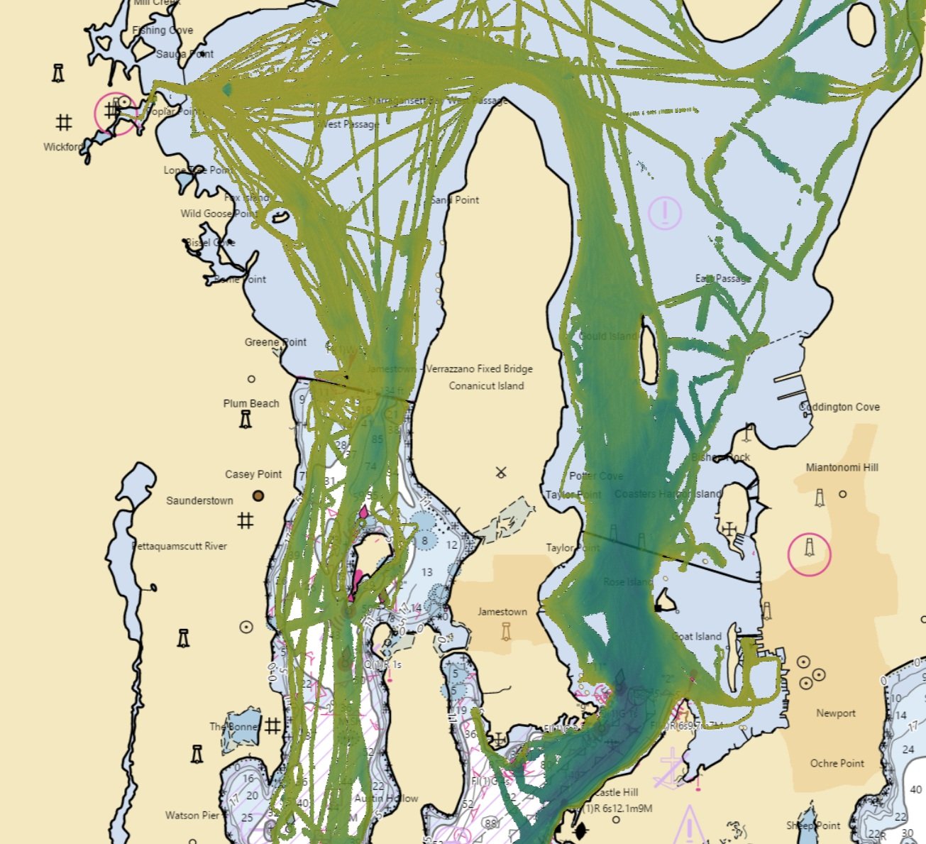
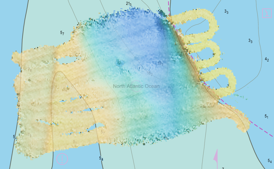
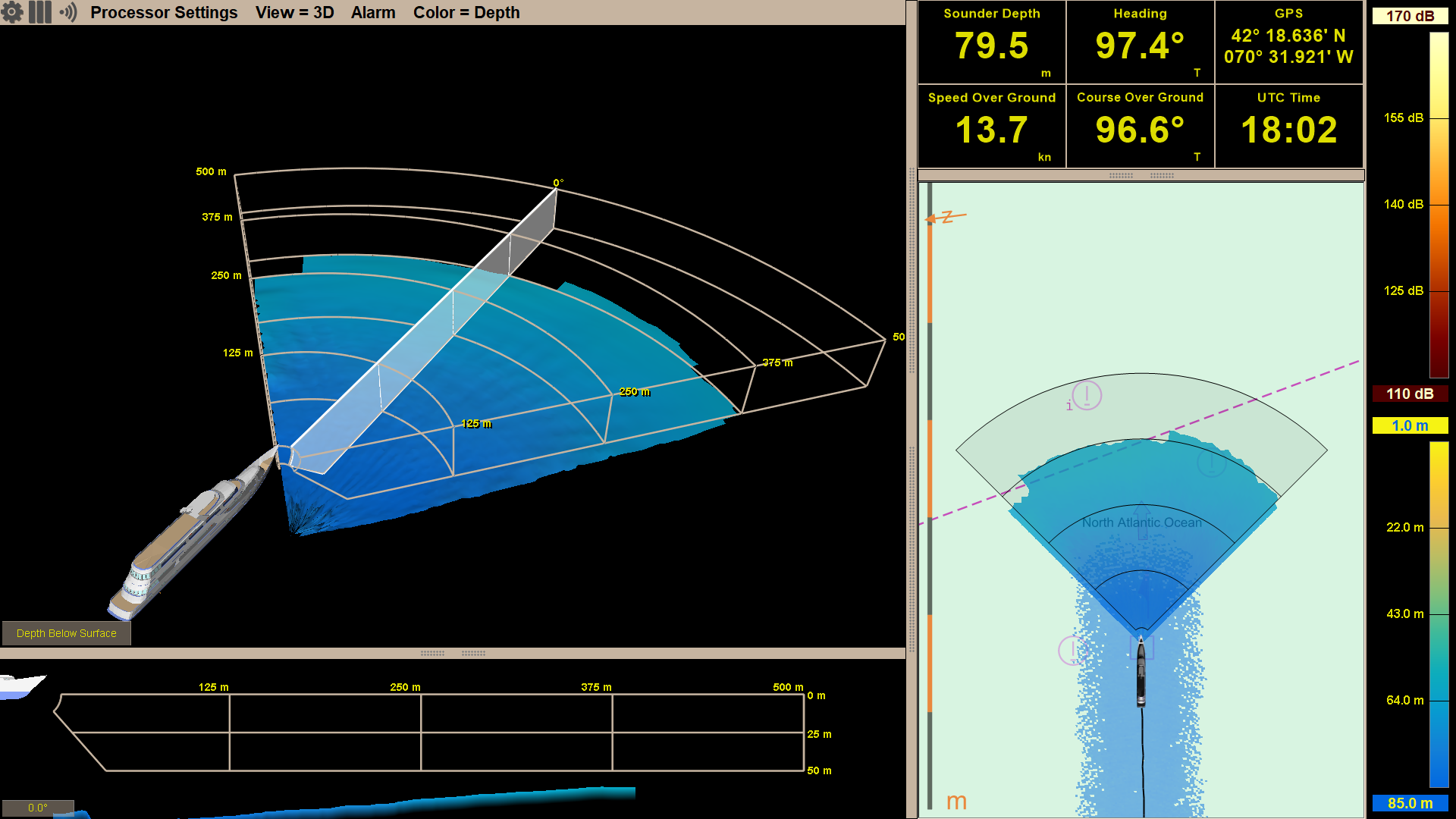
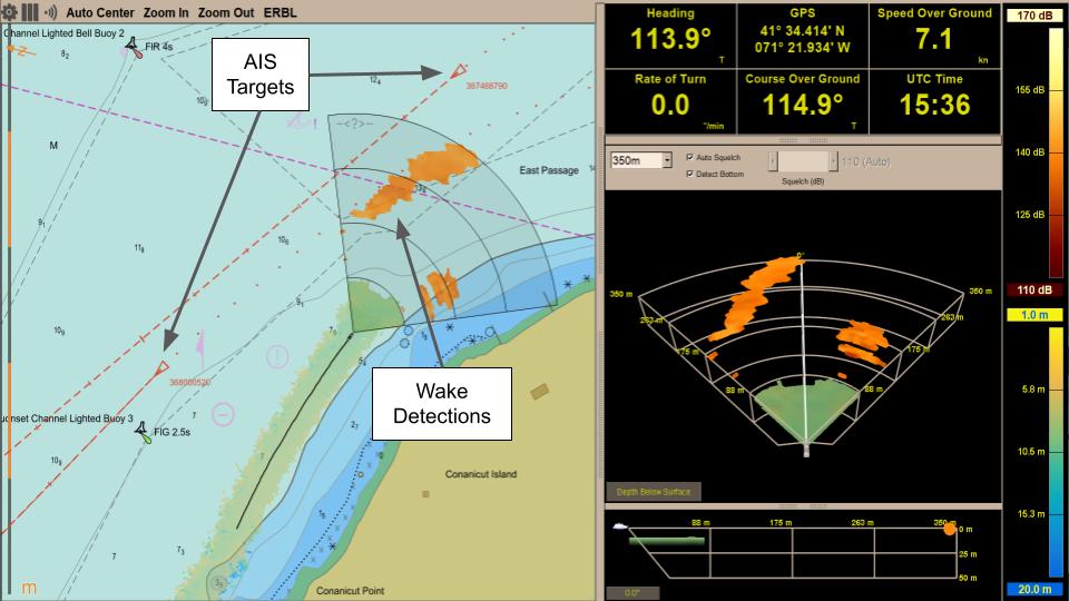
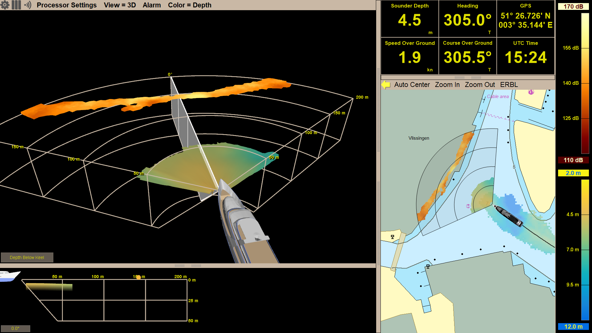
In 2004, we launched our first 3D forward looking sonar products with the capability of producing a real-time image under the water, ahead of the vessel. In 2017, we added our Local History Mapping™ functionality which builds a map of the sea floor as you sail underway.
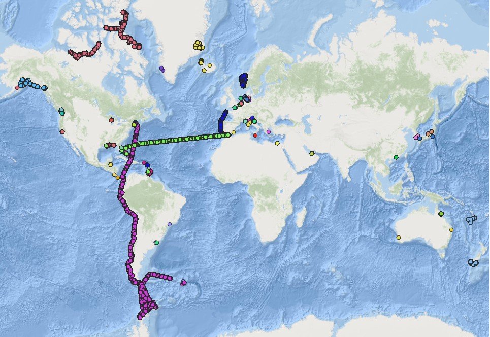
Now in 2023, we are moving that map off the vessel to share across the FarSounder fleet and enabling our customers to contribute to global efforts to build a complete map of the sea floor across all the world’s oceans.
The Pilot Program
While we scale our fleet data sharing capabilities, FarSounder is offering enrollment in our pilot program for select customers with unique itineraries. Participants will receive a beta version of our upcoming software to begin collecting and sharing data.
There is no cost to participants during the pilot program and you will immediately receive the benefit of backing up the Local History Mapping™ you collect in the cloud. You’ll also have the satisfaction of knowing that your contributions to the IHO’s Crowdsourced Bathymetry Database will benefit the community and may be included in the Seabed 2030 initiative.
Future benefits will include access to cloud tide corrected and cleaned versions of the data you have submitted, and access to data from other sources and vessels.
FAQs
Why participate?
Participation in the project will give you
The ability to back up the data you collect with your Argos Sonar to the cloud
Access to bathymetric data from other customers in the pilot program
The opportunity to provide feedback on this pilot program for future improvements.
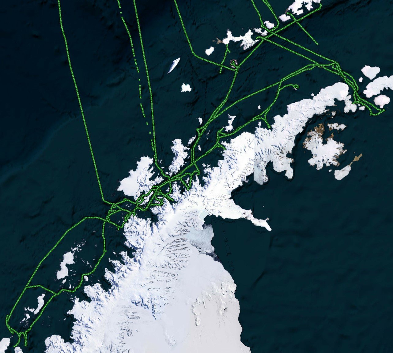
Your participation will also benefit the global community via anonymized data contributions to the IHO’s crowdsourced bathymetry efforts and Seabed 2030. For example, FarSounder customer in the Canadian Arctic recently collected and submitted data to the IHO’s database that was then incorporated into the update of Chat 7053 by the Canadian Hydrographic Service!
What happens to the data after it is uploaded?
The data will be stored for your future use and added to our global bathymetric datastore. This datastore will be used to improve the performance of FarSounder’s sonars and create aggregated data products. Portions of this global datastore will also be shared with FarSounder customers, the IHO’s Data Center for Digital Bathymetry, and Seabed 2030.
Will my information and location be anonymous?
Yes! All data shared across the FarSounder fleet will be anonymized in aggregate form. Contributions to crowdsourced initiatives are anonymized by default. Participants may opt in to include the vessel name if that interests them.
What is my liability for the data I contribute?
None! All data contributions are made in a “good faith effort” and contributed “as is” without guarantee or warranted accuracy. This means that although these data are of high quality and useful for planning and modeling purposes, they are not official charts, and they are not held to official chart survey standards. Official charts should be obtained from the appropriate hydrographic office or their resellers.
What are the requirements?
Internet connectivity to FarSounder bridge computer
Opt-in to participate
Why does the FarSounder computer need internet access?
To synchronize the local data with the cloud server and receive updates from the global aggregated dataset..
What are the connectivity and bandwidth requirements?
A persistent connection is best, but if that is not available connecting the computer to the internet temporarily while in ports with good connectivity is sufficient. Under normal operating conditions about 50 kb of data per second will be uploaded on average in coastal waters under 85 meters of depth. If continuous connectivity underway is not available, then pending data will upload in batches of 500 kb at a time until all data has been uploaded. Similar requirements will be needed for download in the case of downloading, restoring to a new computer, or eventually to pull in additional data layers.
How do you handle areas where bathymetric mapping is restricted?
Some IHO member states do not allow sharing crowd sourced bathymetry data in their waters. In these areas no data will be included in any aggregated data product. However, data you collect in these areas will still be backed up for your own use.
How do I get started?
Request access to the pilot program or contact us at service@farsounder.com with any questions. We will send you an installer for the beta and help get you started!