A First Look at Expedition Sourced Data

Figure 1: FarSounder supplied USB drive ready to be shipped
Recently, FarSounder launched an Expedition Sourced Data Collection program allowing customers to record data during their normal operations. We already have a fleet of customers collecting data as they use FarSounder's real-time 3D-FLS to increase safety in their day-to-day operations. Some of the exciting areas they are exploring include the arctic and antarctic waters, as well as the Caribbean.
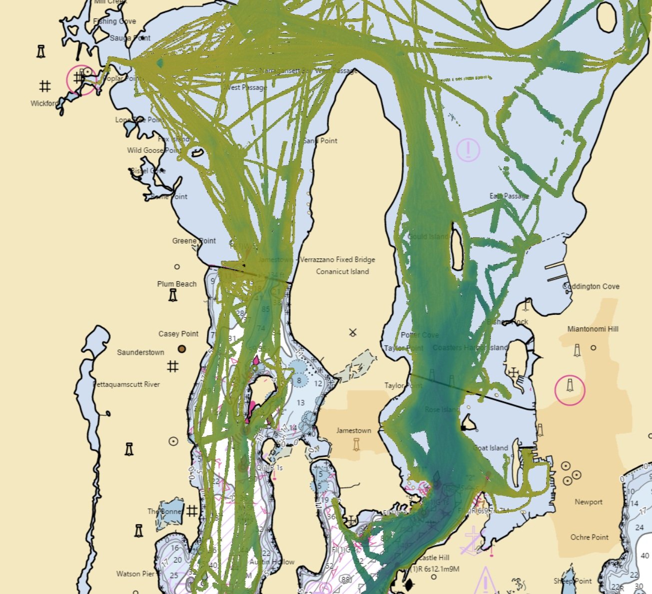
Figure 2: Overall ‘heatmap’ of data points collected by expeditionary cruise customer, starting in Boston, MA, crossing through the Panama Canal, and then continuing down the west coast of South America, to finally perform multiple crossing of the Drake passage to Antarctica. Bathymetric data along this route will be submitted to the IHO DCDB crowd sourced bathymetry database.
Each program participant has a 5 TB data collection drive (Figure 1) saving all of the bathymetric data they collect as they perform normal operations. When the drive is full, it is returned to FarSounder (we send a replacement so recording can continue). Once FarSounder receives the incoming drive, the process of importing and analyzing the data begins. In addition to the many internal applications of this data, including monitoring sonar performance, improving processing algorithms, and expanding mapping capabilities, data collected from customers willing to share anonymized bathymetry will be considered for submission to the IHO/NOAA Crowd-sourced Bathymetry Database. Bathymetry data sent to the crowd-sourced database will benefit global hydrographic offices and mariners in general.
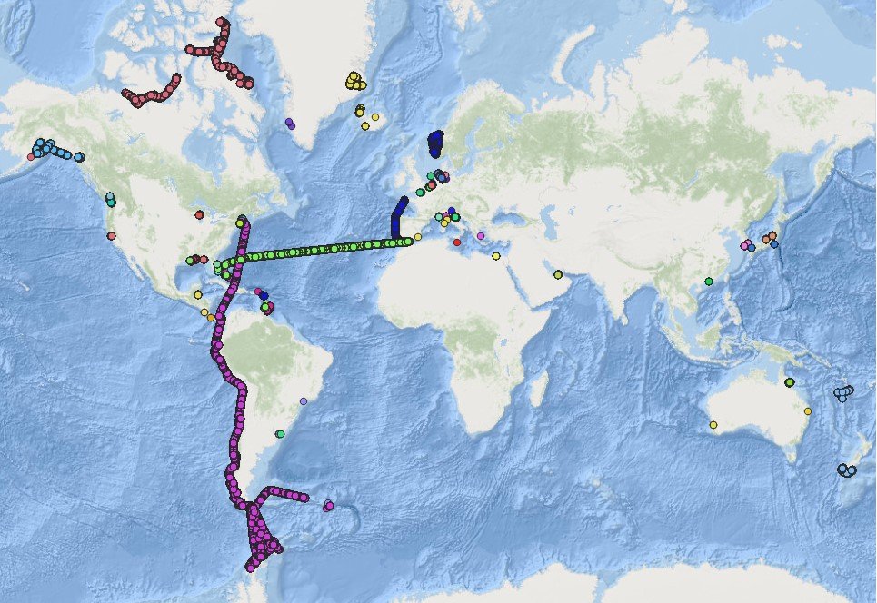
Figure 3: Vessel track line from multiple Antarctica visits.
FarSounder has already received some interesting data from customers. The map in Figure 2 indicates the extent of the data recently submitted by an expeditionary cruise customer. The dataset consists of more than 2 million depth measurements over a span of 95 days of operation. On this particular expedition, the vessel started in Boston, Massachusetts, crossed through the Panama Canal, and then continued south down the west coast of South America to finally perform multiple crossings of the Drake passage to Antarctica (Figure 3).
The bathymetry data collected during this journey will be shared with the IHO crowd sourced bathymetry database. FarSounder is excited to be able to facilitate the contribution of bathymetric data from these remote places, as in many cases they are insufficiently surveyed (according to IHO standards, see publication C-55) to produce reliable navigational charts.
This post is just a first look at the type of valuable data FarSounder customers have the potential to collect. Contributing the bathymetric data to the IHO database is just one way that the value of this type of data can be realized. As more data is received, we are developing more exciting and interesting ways it can be used. Not only by FarSounder customers, but by hydrographic offices or mariners in general.
Contact us if you would like to participate or would like more information about the program.