Expedition Sourced Ocean Data Program: Surveying the Seafloor
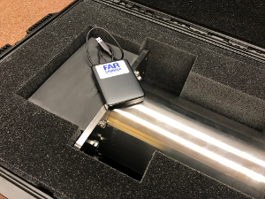
FarSounder supplied USB drive with
a Transducer Module for the
Argos 1000 3D FLS
The world’s oceans and the environments they encompass are vast and varied. The bathymetric contours and acoustic conditions found in the seas, oceans, and bays throughout the latitudes mirror this complexity. FarSounder sonars are designed to bring clarity in these varying conditions to the operators aboard our customers’ ships. Over the years, we’ve amassed many terabytes of sonar data from vessels and locations around the world with varying times of year, installation types, vessel speeds, and signal types. This data is used to continually test new software releases and algorithms.
Over the past year, FarSounder has focused on not only improving algorithms and delivering new features (such as Local History Mapping), but also on exploring capabilities to extend our knowledge about the marine world. This data is also a valuable resource for these endeavors. FarSounder recently became the first (and only) forward looking sonar company to be registered as a trusted node for the IHO’s Data Centre for Digital Bathymetry (DCDB) database hosted by NOAA. This past year we also became an official Industrial Associate of the University of New Hampshire’s Center for Coastal and Ocean Mapping.
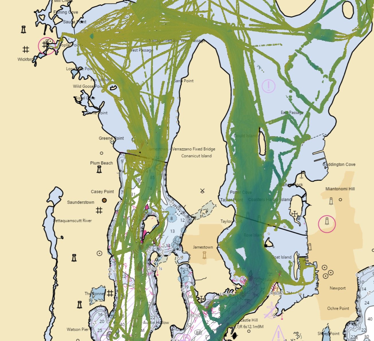
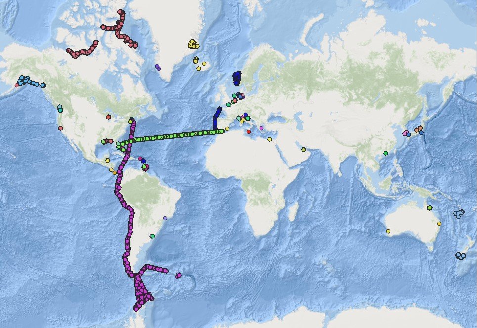
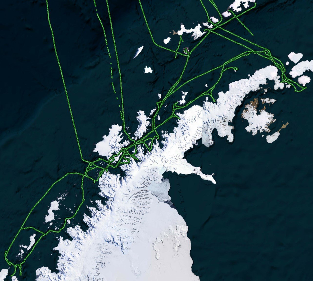
As part of these initiatives, we’ve redoubled our efforts to collect even greater amounts of sonar data from the farthest reaches of the world by working with select customers to record and collect sonar data along their routes. To date, we’ve collected data from locations as varied as Antarctica to the Panama Canal and Japan to Greenland.
We are now expanding our Sonar Data Collection Program to all of our Argos 500 and Argos 1000 customers. As part of this program, customers are supplied with an external USB drive which is able to record raw sonar data. Once full, the drive is sent back to FarSounder, where we then import the sonar data into our engineering database. Customer collected data is useful for us in a variety of ways:
It allows us to monitor the performance of the sonar when used by customers in their actual locations. If the customer experiences any issues or has questions about what they saw with their sonar, we are able to play back the raw data and process it with the same version of the software they have on board.
Improving the performance of our algorithms is something that we are continually working on. By testing our algorithms on data collected in more diverse places and on more vessels, we can better improve our algorithms performance. The improved algorithms are then integrated into future software updates, improving sonar performance for our existing customers.
While focusing primarily on our systems’ real-time applications, we are also continuing to expand on our products mapping capabilities. Customer collected data is helpful as we improve our products’ abilities to merge and combine large data-sets.
Through participation in the program, FarSounder customers may also optionally contribute bathymetric data to IHO/NOAA’s Crowd-sourced Bathymetry initiative. Collecting and contributing bathymetric data to the IHO/NOAA CSB database will benefit all mariners as hydrographic offices around the world work to improve and update nautical charts.
Contact us to request your drive and join this program today.