Datasharing, Crowdsourcing and Community Contributions

Image Credit: NASA/JPL-Caltech
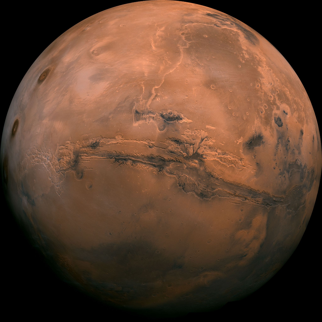
“We know more about the surface of Mars than we do about the seafloor here on earth” is a rallying cry that has been heard across the marine world. Perhaps you are interested in a better understanding of our world and want to know if you might be able to help improve our knowledge. Crowdsourcing, data sharing, and citizen science initiatives are common terms, but understanding how you and your vessel can contribute to these efforts can be confusing. Where should you be contributing to? How do you do it? Who can access the contributed data? What impact can you have? Are there privacy or liability concerns to consider? Is your data valuable to the community? This tech blog is intended to clarify your options and explain how to get involved using an Argos forward looking sonar.
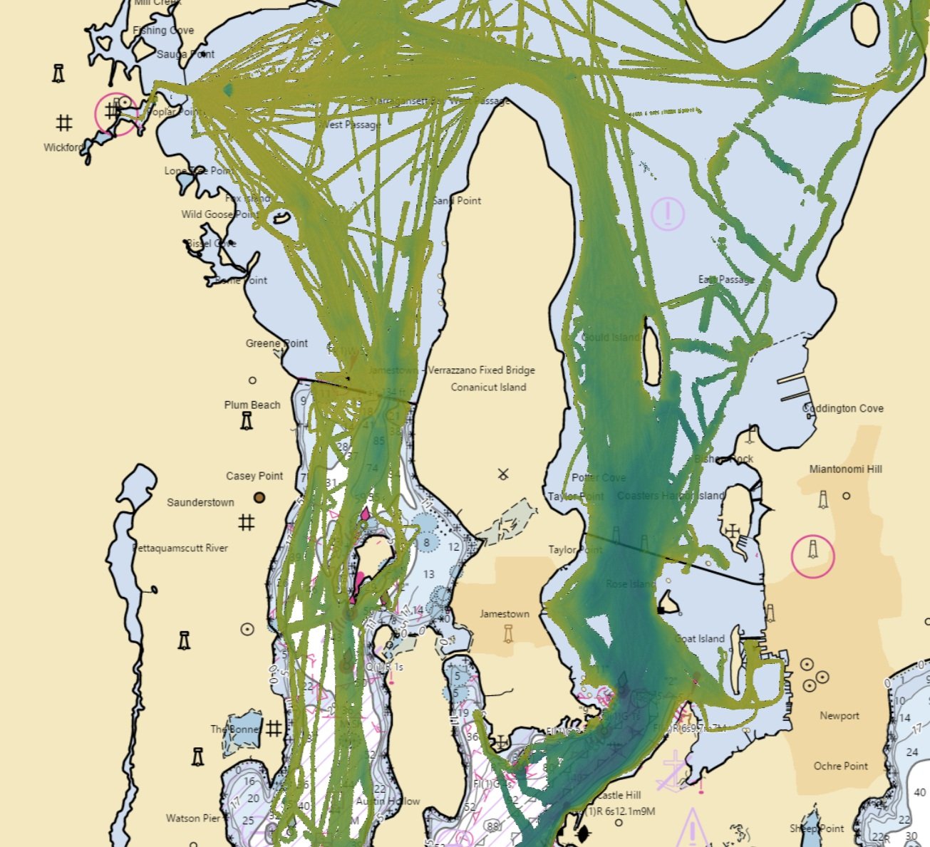
FarSounder’s Argos obstacle avoidance sonars have been designed as real-time sensors to look ahead, underwater in front of a vessel. These navigation systems are clear compliments to radar and camera systems which look ahead above the water. Though Argos sonars’ core value proposition is looking forward, they also have the ability to build a map of every where the vessel goes. We call this feature our Local History Map™ (aka LHM™ data). This information is valuable to you, the vessel operator, but it is also valuable to the community as a whole.
Building the Map

FarSounder’s Local History Map is displayed with its 3D Forward Looking Sonar
The Argos sonar’s Local History Map is automatically generated from all the best bottom returns detected from the Forward Looking Sonar data without the need for any user intervention or manual adjustments. The resulting LHM data is displayed in both the software’s 3D Omni View and Chart Overlay View. If tide information is imported into our software, the Local History Map is continually updated, limited only by the computer’s drive space. If no tide information has been imported, the LHM data is limited to approximately 1 hour duration (since in most places, most of the time, the tidal change within 1 hour is not dramatic enough to require adjustment as compared to the current depth).
Sharing Across the Fleet
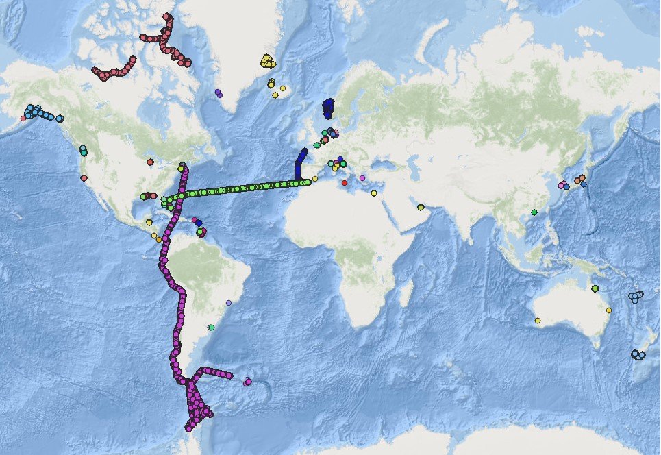
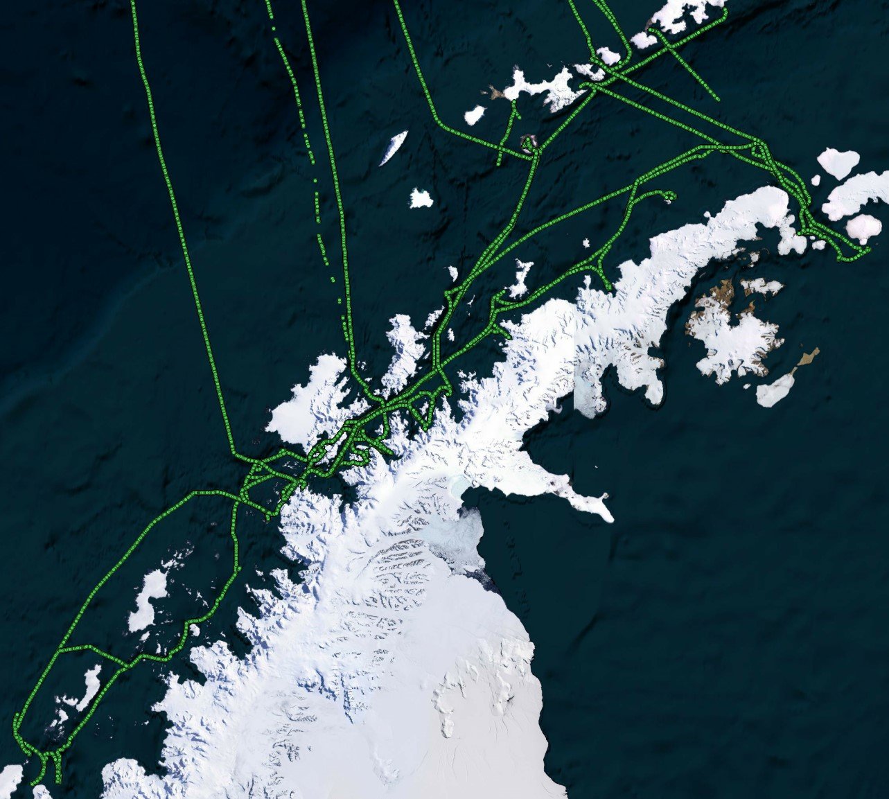
By default, each vessel’s Local History Map lives onboard the FarSounder bridge computer. However, FarSounder’s recently launched pilot program to share data across the fleet expands access to this data. Program participants are able backup their LHM data to FarSounder’s cloud service, anonymously share their LHM data with other FarSounder customers and receive a tide corrected, aggregate map built from the fleet of LHM contributions. Additionally, from FarSounder’s cloud service, contributions will also be shared with the global community via the IHO’s crowd sourced bathymetry database and Seabed 2030.
A Deeper Look at Raw Data
Separate from our LHM fleet sharing service, FarSounder also invites select customers to participate in its Expedition Sourced Ocean Data Collection Program. As part of this program, customers are supplied with an external USB drive which is able to record raw sonar data. Once full, the drive is sent back to FarSounder, where we then import the sonar data into our engineering database. The quantity of data collected under this program is much higher than with our fleet sharing program and requires considerable time to process and analyze. For this reason, we focus on recruiting participants who have interesting itineraries well off the beaten path and in a wide range of environments.
FarSounder has continually invested in this data collection program for a number of reasons. This data aids in the improvement of existing, and the development of new, processing methods and algorithms. Users reap the benefits of these engineering efforts, fed by their contributions, through no-cost software updates FarSounder releases multiple times per year. Contributions to the global community can also be made via this program.
Global Efforts to Map the Oceans
It is clear that mapping our oceans is an important step in understanding our world better. One way to help complete the map is by leveraging depth measurements from the wider maritime community, not just the hydrographic survey community. A quick search through maritime media for crowdsourcing and community contributions will result in a number of different organizations, names and initiatives. This is quite confusing even for those deeply engaged in the industry. So let’s take a moment to clarify how these relate and where contributions from FarSounder customers are made available to the global community.
The IHO / NOAA
A key facilitator of crowd sourced bathymetry (CSB) data is the International Hydrographic Organization (IHO). The IHO is an intergovernmental organization based in Monaco that works to ensure all the world's seas, oceans and navigable waters are surveyed and charted. Established in 1921, it coordinates the activities of national hydrographic offices and promotes uniformity in nautical charts and documents. It issues survey best practices, provides guidelines to maximize the use of hydrographic survey data and develops hydrographic capabilities in Member States.
The IHO organizes a number of working groups including the Crowdsourced Bathymetry Working Group (CSBWG). The mission of this working group is to develop the standards and practices for CSB data as well as enable participation by the global community to contribute depth measurements around the world. The working group spearheaded the effort to create an IHO database for these crowdsourced measurements called the Data Center for Digital Bathymetry. FarSounder has been an active member of the CSBWG since 2018. We’re also a Trusted Node of the DCDB which means that we are one of the conduits for uploading contributions into the database. All contributions distributed via the DCDB are available to anyone of access at no charge.
Most coastal countries are member states and participate in the IHO. The United States is an active member of the IHO with participation primarily via NOAA (part of the the US Department of Commerce and the primary US agency in charge of hydrographic activities in US waters). NOAA is a world leader in the development of hydrographic technologies and it hosts the IHO’s Data Center for Digital Bathymetry (DCSB) at its Colorado campus.
Seabed 2030
Seabed 2030 is a joint project of the Nippon Foundation and GEBCO with the goal of mapping the world’s oceans by 2030. Seabed 2030 has done a fantastic job of rallying the global community with its outreach and has become a “household name” in some parts of the maritime industry. It is endorsed by the UN and operates in close collaboration with the IHO. GEBCO's aim is to provide the most authoritative publicly-available bathymetry of the world's oceans. It operates under the auspices of the IHO and the Intergovernmental Oceanographic Commission of UNESCO. The GEBCO map (this is the “Seabed 2030” map) is built from a variety of survey data including CSB contributions.
To state it simply, all contributions to the IHO’s DCDB are included in Seabed 2030’s efforts and are sources for the GEBCO map. We make it easy for our customers to contribute to these efforts by uploading anonymous submissions for them to the DCDB which are then passed on the Seabed 2030 for inclusion in the GEBCO map. Plus all of our customer’s contributions are available directly from the DCDB. Some potential participants have voiced concerns about the privacy and liability of these contributions. By default, all contributions to the DCDB are anonymized and no warranty of the data is provided. Furthermore, all contributions to the DCDB under Creative Commons Zero universal public domain dedication (CC0 1.0) and are not considered hydrographic surveys for navigational use.
In recognition of FarSounder’s efforts to facilitate contributions and promote the Seabed 2030 message, we’ve recently become an official partner of Seabed 2030. We’ve found that many FarSounder users want to contribute to this goal and we’re happy to make it as easy as possible to enable them. Unlike other mapping products which focus on generating a private database only for their paying customers, FarSounder is committed to facilitating publicly accessible contributions. As part of our fleet sharing service, we will be continually submitting FarSounder user generated contributions to the DCDB at resolutions meeting or exceeding the needs of Seabed 2030.