
Improving the situational awareness of obstacles below the sea surface is the reason we developed our 3D forward looking sonars. True Target Motion™ is our latest innovation for improving upon that awareness. This new software feature combines inputs from the ship’s heading and GPS sensors with our navigation sonar data to animate the movement of detected sonar targets relative to the vessel between each ping. Without True Target Motion™ the position of each sonar target can only be updated once every ping. Now, target positions are updated as the vessel moves between pings.

Without True Target Motion, the location of targets is updated once every ping. The different color outlines represent data from separate pings.

With True Target Motion, target locations are updated continually based on vessel motion independent from the ping update rate. The different color outlines still represent data from separate pings.
Continually Improving Situational Awareness
FarSounder’s True Target Motion™ capabilities are available in the current version of the SonaSoft software. To existing users, upgrading is free and easy. In addition to all of the other improved processing and display improvements you'll see by updating, True Target Motion™ will enhance the real-time nature of both your 3D bathymetric display and your navigational chart overlay. To new customers, this feature should simply be a very natural extension of the already intuitive way your FarSounder sonar improves your underwater navigational awareness.
Installation Requirements
To enable this option, heading, rate of turn, speed over ground, course over ground, and lat/lon must be provided to the FarSounder software via standard NMEA 0183 messages. Rate of turn must be provided at 10 Hz or faster while other messages must be provided at 1 Hz or faster.
The software also requires a FarSounder bridge computer with suitable processing capabilities. Our recommended computer specifications can be found here.
For customers who want to receive the latest software, simply send us a request here.
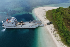
FarSounder’s Argos 3D Forward Looking Sonars are being installed on a growing number of modern landing craft and USVs, giving operators critical insight into the subsurface environment ahead. Providing real-time underwater perception, FarSounder’s Argos sonars can reliably map the seafloor ahead and detect obstacles in the water column at distances out to 1000m.
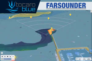
FarSounder's integration with Tocaro Blue's ProteusCore™ platform extends interoperability across its navigation ecosystem. Available within SonaSoft LT™, FarSounder's browser-based navigation interface, the integration combines AI-enhanced Radar perception with Argos 3D Forward Looking Sonar data to deliver a richer operational picture for vessel operators.
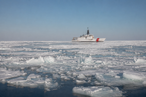
Expanding high-latitude operations, the United States Coast Guard plans to add 11 new Arctic Security Cutters to their icebreaker fleet. The Coast Guard’s investment reflects a broader reality, the Arctic is an increasingly contested and economically significant region where maritime access, scientific research, and multi-national security converge.

A new integration with Anschütz GmbH, a global leader in maritime navigation technology, now allows Argos FLS data to be displayed within their SYNAPSIS (W/)ECDIS NX application. This new collaboration combines FarSounder’s subsurface awareness with advanced Electronic Chart Display and Information Systems (ECDIS), providing a more unified and data-rich navigation experience.

Our Argos sonars produce two types of data: 3D Forward Looking Sonar data (that’s the realtime image ahead of the vessel, inside the sonar’s field-of-view) and Local History Map data (the depth map of everywhere the vessel goes).
By default, all data lives aboard the vessel on the FarSounder bridge computer. However, users can opt-in to anonymously share their Local History Map data across the FarSounder fleet. In exchange, they receive the aggregate map built from everyone’s contributions. Plus, we contribute depth measurements anonymously on their behalf to Seabed 2030, a global effort to help map the world’s oceans.
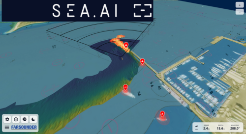
FarSounder has expanded its suite of integration options with the addition of SEA.AI, a global leader in AI-powered vision systems for maritime safety. This integration is available in FarSounder’s new SonaSoft LT™ web application, providing captains and bridge crews with a more comprehensive operational picture.
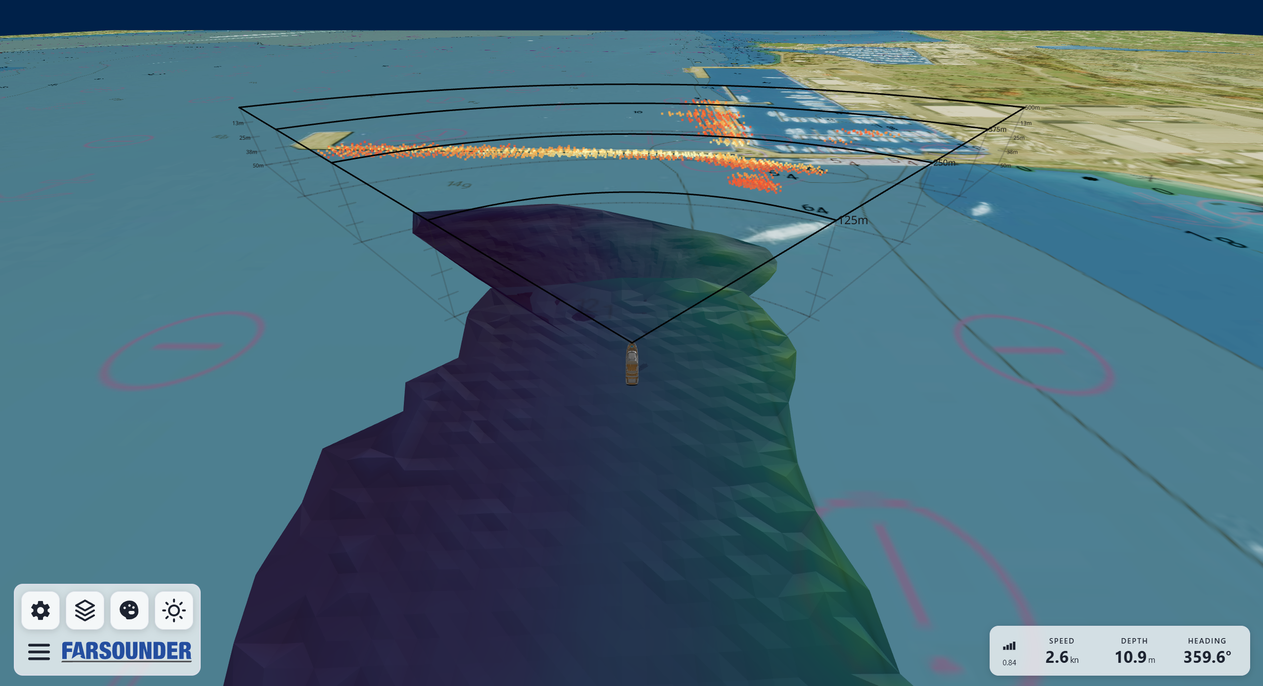
FarSounder offers multiple ways for users to quickly and intuitively interact with the underwater information collected by their Argos 3D forward looking sonars. All sonar data is accessible via SonaSoft™ (Windows desktop app), SonaSoft LT™ (web app), and/or 3rd Party Integrations (Network API).
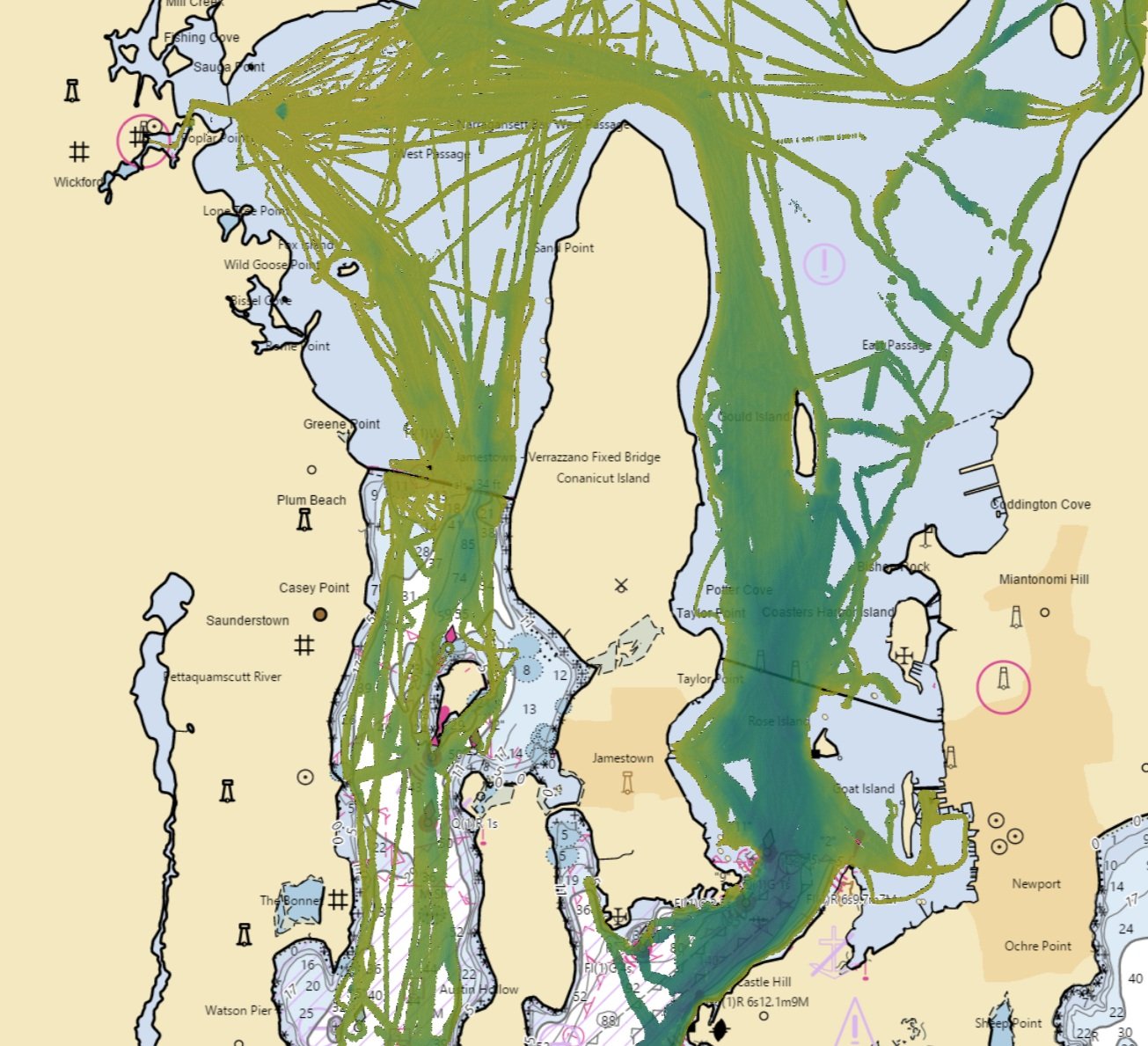
We are moving our Local History Map™ off the vessel to share across the FarSounder fleet and enabling our customers to contribute to global efforts to build a complete map of the sea floor across all the world’s oceans. Participants receive the benefit of backing up the Local History Map™ they collect in the cloud and have the satisfaction of knowing that contributions will benefit the community and may be included in the Seabed 2030 initiative.
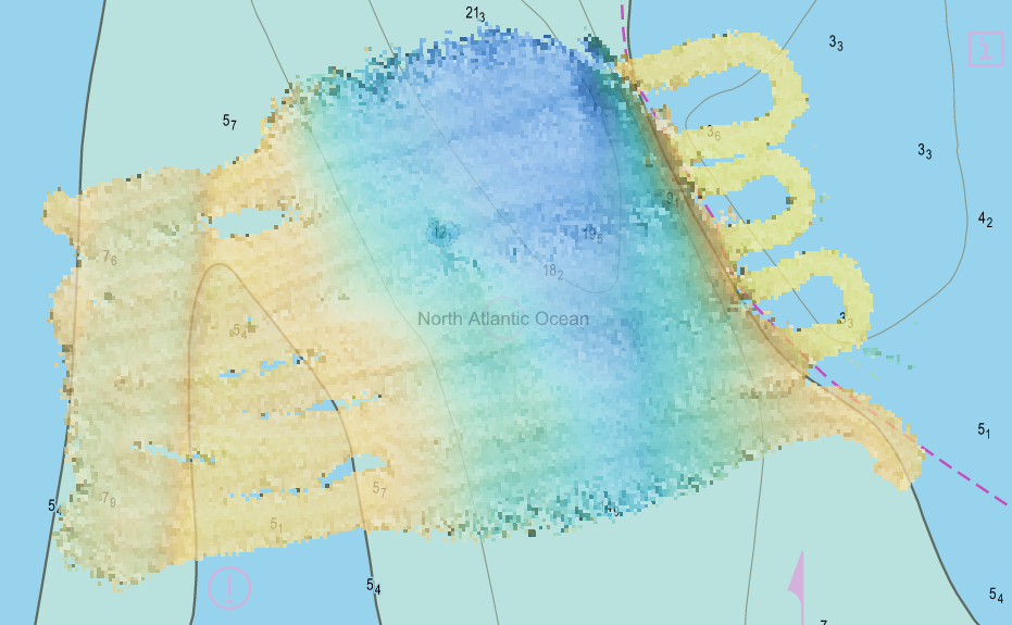
All Argos sonar systems use FarSounder’s SonaSoft™ processing software for processing and display. Real-time sonar data is displayed via a 3D representation in the 3D Viewer and also in a “top down” representation overlaid on an ENC chart. In addition to detecting the seafloor ahead of the vessel and navigation hazards in front of the vessel in real-time, a history of bathymetric data is stored as the vessel moves along its route. This data is an average of the seafloor detections over all of the pings that contained this area. It is most commonly displayed with color mapped to depth. Essentially, a map of the seafloor is created from the vessel’s recent history and displayed for operator use.
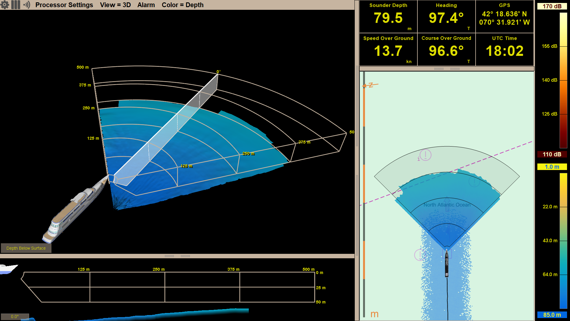
FarSounder Argos 3D forward looking navigation sonars look for both the seafloor and potential navigation hazards anywhere in the water column ahead of the vessel. Hazards in the water column are detected as in-water targets and can be detected out to full range of the sonar (dependent upon target size). While the maximum in-water target detection range is a set distance for each product, maximum bottom detection range is not. The maximum bottom detection range, or bottom mapping range is dependent on the depth of water below the transducer module, not the Argos model.
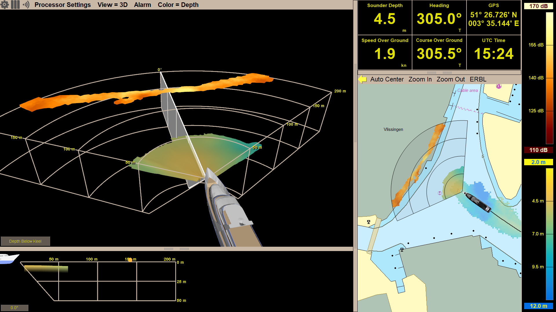
Did you know the Argos sonar systems offer dynamic fields of view? This gives the user different range options to choose from based on the marine environment and use case. In order to get the best sonar performance and most accurate detections, the operator is able to alter the mode accordingly. When transiting at significant speeds, operators will most likely want to use the longest range mode, giving them the most reaction time to any navigation hazards. While maneuvering through coral heads or looking for anchorage spots and traveling slower, users will many times prefer to be using a short range mode.
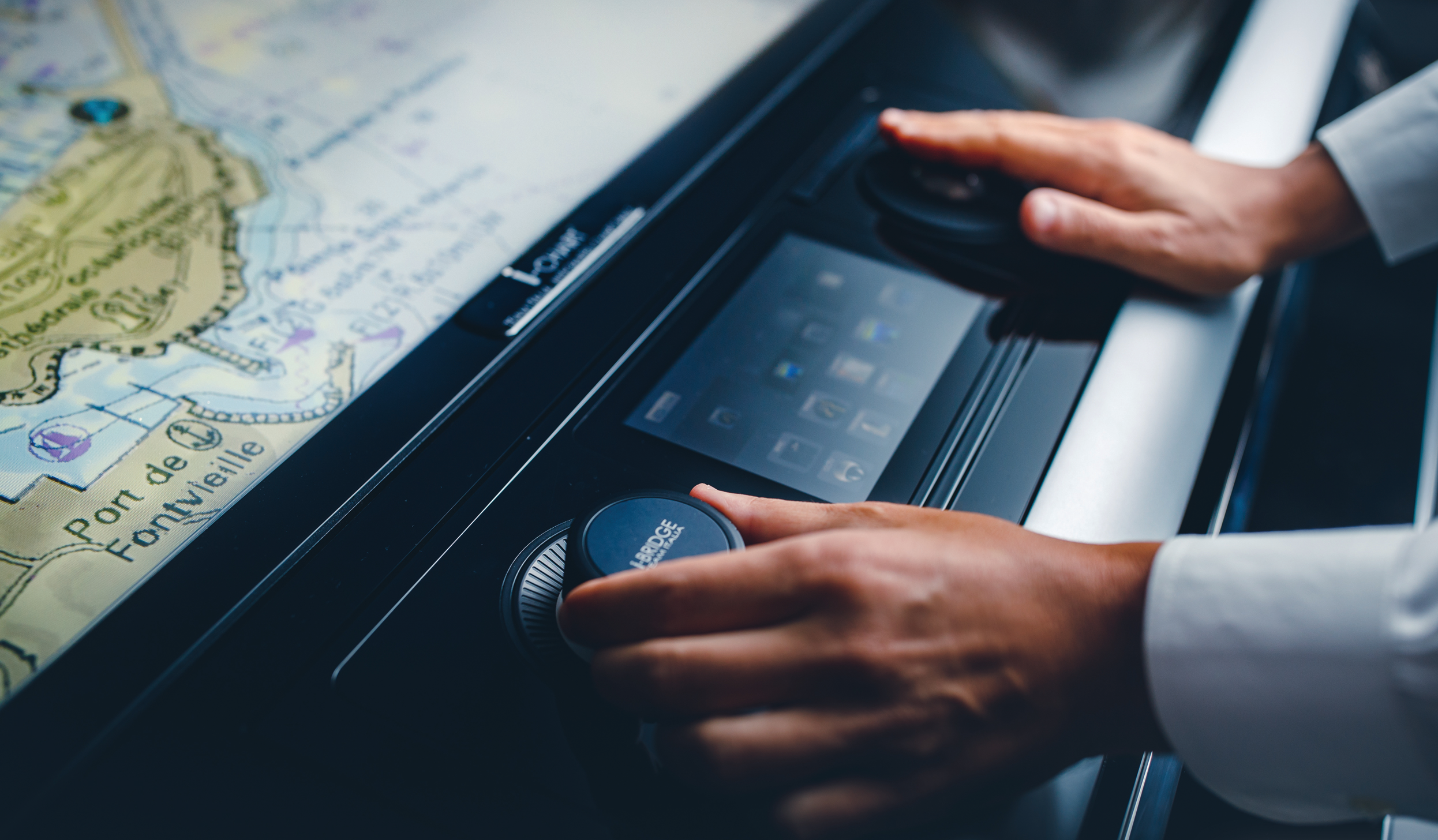
Integration flexibility is one of the key aspects to FarSounder’s software. Since SonaSoft 3.0, all end user features can be controlled with only a 2 button mouse/trackball and the design of the user interface facilitates the use of touch screen monitors. We also offer low level integration via a network based SDK.
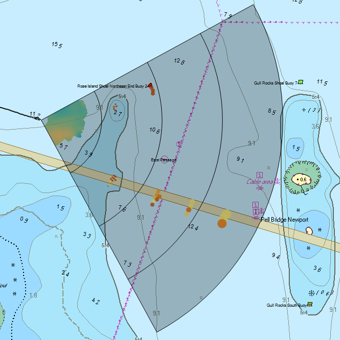
FarSounder forward looking navigation sonars are unlike any other sonar on the market. Our sonars generate a complete 3D image ahead of the vessel at navigationally significant ranges with each and every ping. Because our technology differs from all other sonar products, we try to be very straightforward and clear about what our products can and cannot do. The purpose of this posting is to highlight the unique capabilities that users can expect from our navigation products as well as outline the general installation and interfacing requirements.
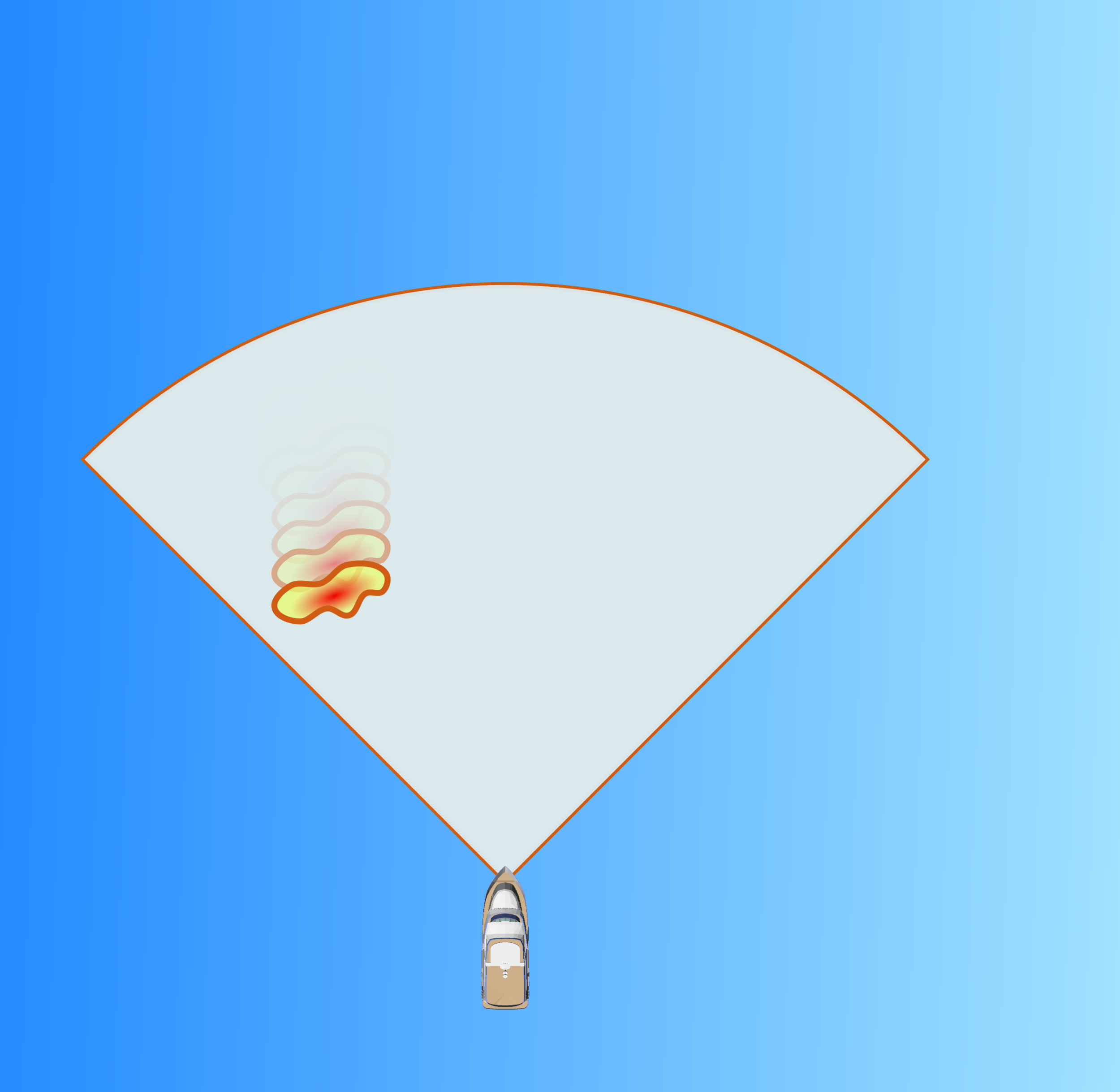
Improving the situational awareness of obstacles below the sea surface is the reason we developed our 3D forward looking sonars. True Target Motion™ is our latest innovation for improving upon that awareness. This new software feature combines inputs from the ship’s heading and GPS sensors with our navigation sonar data to animate the movement of detected sonar targets relative to the vessel between each ping. Without True Target Motion™ the position of each sonar target can only be updated once every ping. Now, target positions are updated as the vessel moves between pings.
