Operating at the Edge: Underwater Perception in Polar Maritime Environments
Expanding high-latitude operations, the United States Coast Guard plans to add 11 new Arctic Security Cutters to their icebreaker fleet. The Coast Guard’s investment reflects a broader reality, the Arctic is an increasingly contested and economically significant region where maritime access, scientific research, and multi-national security converge. Operating effectively in this environment, however, requires confronting a set of challenges that differ fundamentally from traditional maritime locations.
Proven Operations in Polar Waters
FarSounder’s Argos 3D Forward Looking Sonars are already deployed on vessels operating in these environments today. Expedition cruise ships, polar research vessels, and naval platforms, some of which are icebreakers, leverage Argos sonars to safely navigate these isolated regions that bring increased risks and limited support. Having real-time awareness of the underwater environment that lies ahead directly impacts their ability to operate in some of the most remote and unforgiving waters on Earth.
Navigating in Polar Regions
Polar operations introduce unique hazards that complicate even the most routine operations. Floating ice in these environments present increased risk, as the visible portion above the surface may not accurately represent the size and shape of submerged ice keels below the waterline. Accurate chart data is sparse, and in many cases, non-existent, leaving shallow bottoms and rocky pinnacles below the surface a mystery. High-latitude environments and magnetic anomalies can degrade the reliability of GPS and satellite communications while harsh weather conditions reduce the effectiveness of radar and optical sensors.
These challenges are amplified by isolation. Search and rescue operations in polar regions face extreme challenges, complicating both the detection of vessels in distress and the ability to safely reach them. Furthermore, incidents in remote, hard to reach waters pose an increased risk to marine life and the environment. Oil spills caused by groundings and collisions are more difficult to contain in polar waters due to harsh operating environments and limited response capacity. These regions are home to a variety native and migratory whale species, many of which are endangered. Human factors including vessel strikes remain the leading cause of death for whales, further elevating the environmental risk of maritime operations in these regions.
Underwater Perception Solution
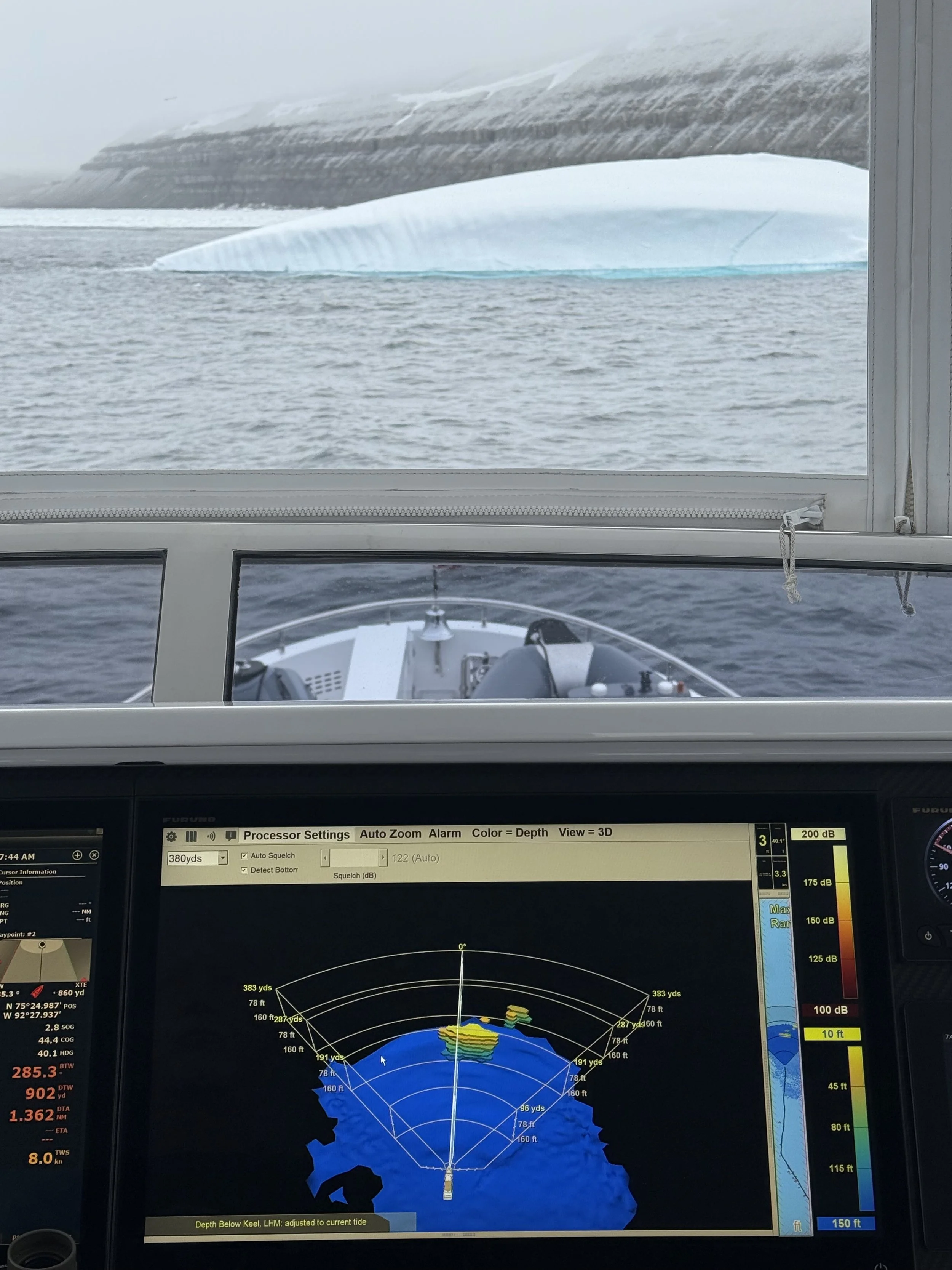
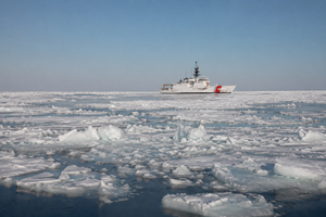
A vessel equipped with an Argos 350 detecting ice.
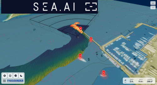
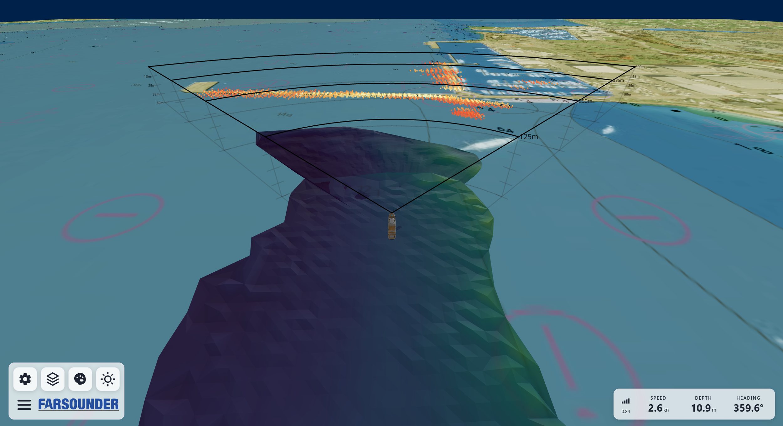
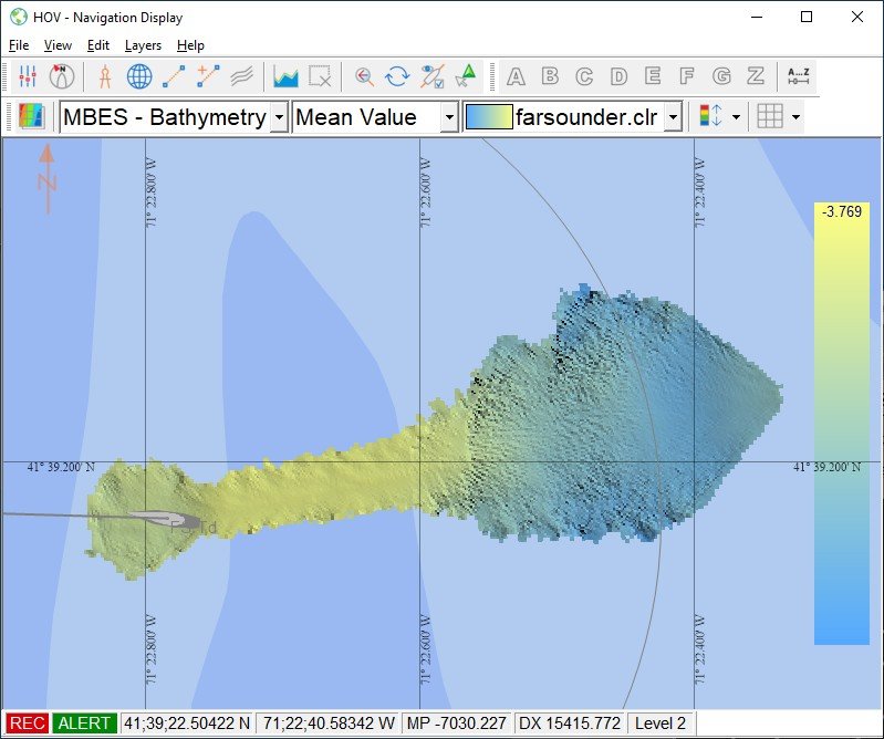
For 25 years, FarSounder has developed Argos 3D Forward Looking Sonar systems designed to provide real-time situational awareness of what lies beneath the surface ahead of the vessel. Argos sonars provide a real-time 3D image of the water column and seafloor out to distances of up to 1000 meters, enabling operators to make informed decisions before hazards become immediate threats. The Argos system’s low-frequency operation ensures that acoustic output remains benign to marine life, while still enabling the detection of large marine mammals such as whales.
Ice, in particular, is an ideal sonar target. Its dense, reflective structure produces strong acoustic returns, allowing Argos systems to detect submerged ice masses that lie beneath the surface. At the same time, it maps the seafloor ahead at ranges of at least eight times the water depth below the sensor. In poorly charted or uncharted waters, this capability reveals shallows and obstructions like rocky pinnacles extending from the seafloor and hazards in the water column including whales.
In environments where GPS is degraded, communications are intermittent, and charts are unreliable, Argos systems continue to deliver consistent, real-time data. With a rapid update rate and the ability to scan from the seafloor to the surface in a single ping, operators gain a continuous understanding of the space ahead
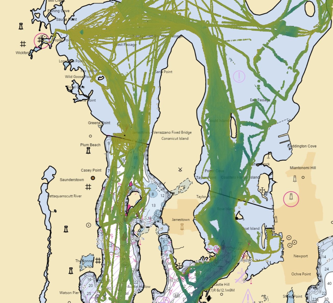
Beyond underwater perception ahead, Argos sonars also create a map of the seafloor everywhere they go. Recorded depth measurements are recalled when returning to a previous location, allowing vessels to identify and follow safe routes where chart data is unreliable. The sonar’s software enables this data to be anonymously shared across the FarSounder fleet. In return, vessels will gain access to an aggregate map of all other customer contributions. This program also supports global ocean mapping initiatives like Seabed 2030.
These crowd sourcing efforts have been able to provide tangible value for the broader maritime community operating in Arctic regions. Bathymetric data provided by one of our customers transiting the Northwest Passage directly supported an official chart update by the Canadian Hydrographic Service.
Installation on Ice-Class Vessels
Argos sonars are deployed across a range of vessel types operating in polar environments, with installation approaches tailored to mission requirements. On many ice-class vessels, systems are installed in a slightly recessed, fixed position as far forward as possible and below the vessel’s ice draft, maximizing forward detection capability while maintaining protection from ice interaction.
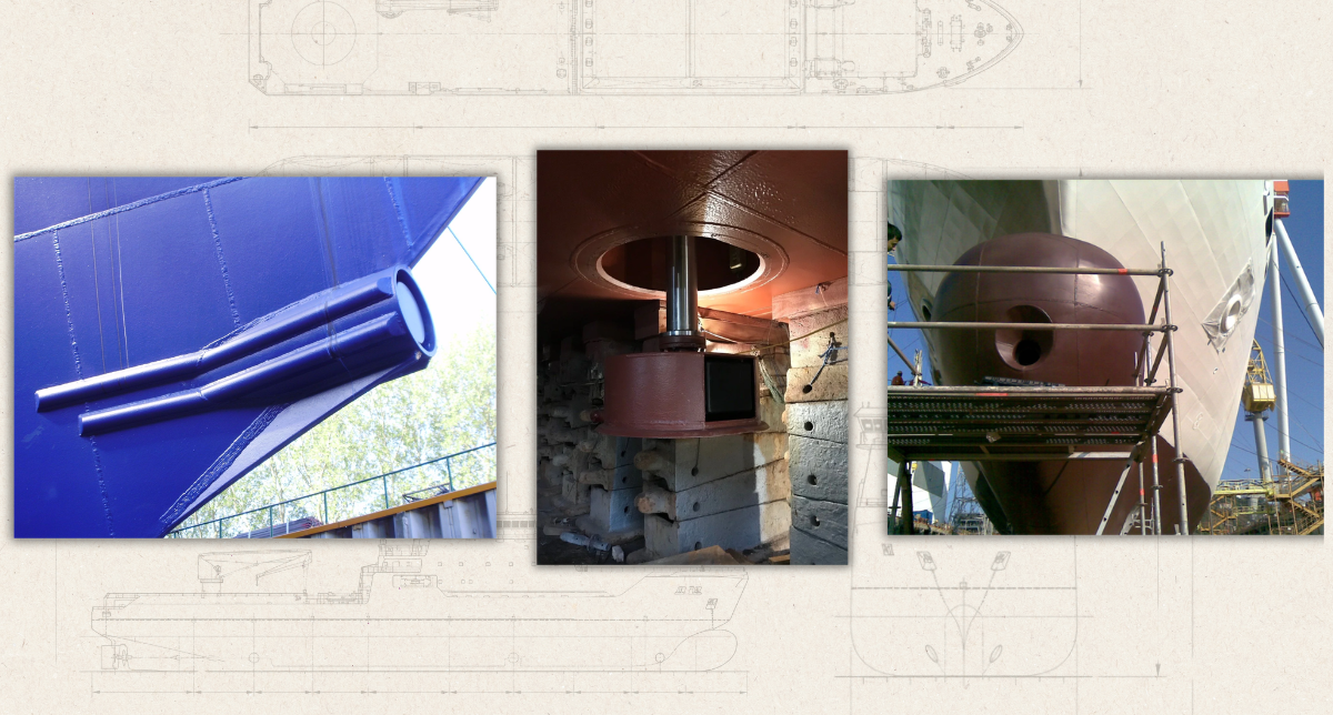
Argos FLS installed on ice-classed vessels in fixed and hoist-mounted configurations.
Icebreakers, which operate under more aggressive ice conditions, often employ retractable or hoist-based installations. This allows the sonar to be deployed when forward-looking awareness is required and retracted flush with the hull during active icebreaking operations, preserving the integrity of the sensor array.
These flexible deployment options ensure that forward-looking sonar can be integrated without compromising vessel performance or mission capability.