The Evolution of Forward Looking Sonar
Twenty Years of Safe Navigation
FarSounder Customer exploring a polar region
Time is like the ocean; you can only hold a little in your hands. Time passes though your fingers so fast. As we look back on the last twenty years, we can’t believe how much it has flown by. It seems like yesterday we were testing the early versions of this technology. So much has happened since then, and the technology has come so far.

A few of the original FarSounder Crew setting up for a test in the early days
Over the years, FarSounder users have been breaking records and pushing the boundaries of safe navigation.
Customers use the FarSounder sonar to help navigate through shallow water archipelagos of the South Pacific.
A Captain reported back to us while on the Volga River, with maximum depths of 25', of seeing Buoys on the screen as well as the shallows.
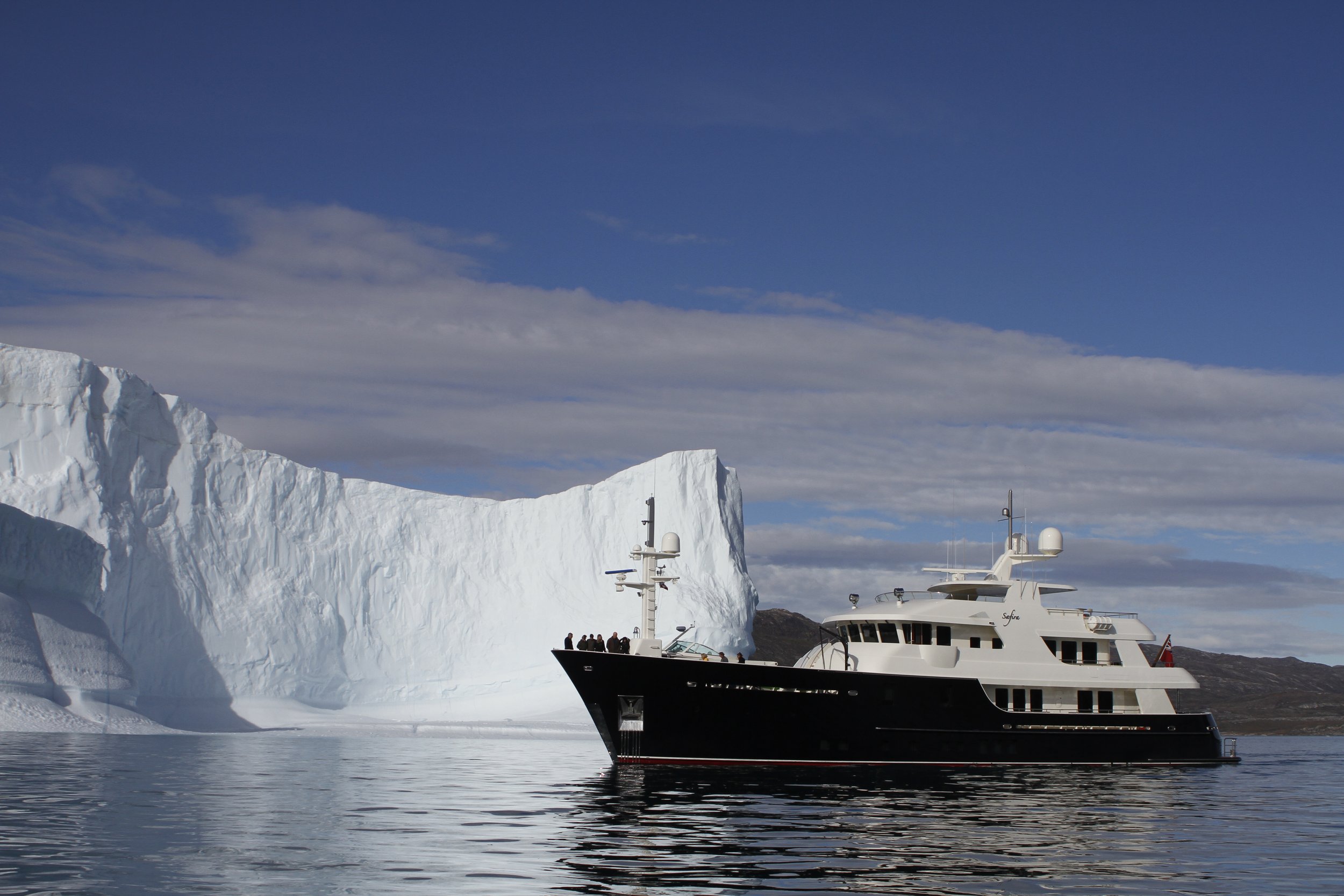
Yachts traveling around Greenland reported the FarSounder systems showing growlers and bergy bits when traveling up the fjords, as well as mismarked charts where the sonar was crucial in keeping them safe.
In 2017, The World set the world record for the most southerly navigation while exploring the Bay of Whales in Antarctica’s Ross Sea.
Learn more from Argos FLS users as they share their experiences using the systems in the real world during a virtual round table hosted by ACREW.
The Early Years of FarSounder
It all began in 2001 when an ocean engineering student and his professor had the drive to make a difference in the world of oceanography through the prevention of accidents. It was shocking to know there was no technology that allowed vessels to see what is under the water in front of their vessel. They saw the need for a Forward Looking Sonar for navigation and set out on a mission to protect lives and the vulnerable underwater ecosystem.
"We've been told that we've broken the laws of physics with this technology, but we haven't. We've just opened the world up below the water line," said James Miller, a professor of Ocean Engineering at URI, and co-founder of the technology along with former student Matthew Zimmerman, currently FarSounder’s Executive Vice President of Engineering. "This is a revolutionary leap for marine navigation, especially since most navigational charts in use today are more than 70 years old and many waterways are constantly changing."
In 2002, the first proof of concept was created. After a series of testing and remodeling, the product launched for sale in 2004. The first model of Forward Looking Sonar was the FarSounder FS-3 Navigation & Obstacle Avoidance System giving users a maximum range of 330 meters (~1,000 feet), a 90 degree field of view, and a refresh rate of just two seconds. For the first time marine vessels had a view in front of the vessels in real time and in turn, the ability to avoid collisions with submerged obstacles giving the marine industry a new way to protect them from costly accidents.
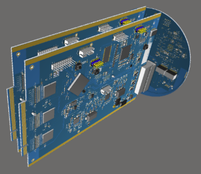
FarSounder has grown over the years and is now developing and designing its custom electronics and SonaSoft™ software completely in-house, which is one of the reasons their 3D forward looking sonar has come so far today.
Patented Technology
There was much success right from the start and the team discovered they had something really special. It was time to have the technology patented. FarSounder holds both software and hardware patents.
The Company’s patent portfolio includes six patents for their 3D Forward Looking Sonar technology. In 2006 through 2008, four US patents were obtained including one for High Resolution Obstacle Avoidance and Bottom Mapping Array Processing Technique and one for 3D Forward Looking Sonar with Fixed Frame of Reference for Navigation.
In 2019, the company received their first Japanese patent. This patent relates to the invention of integrated sonar devices and methods. The issuance of the 5th US patent came in 2020. It was related to integrating acoustic data from the sonar system with other down-looking sonar and side-scanning sonar. This allows vessel operators to have an expansive display in the boat providing them with valuable information in a variety of directions. Having this information can increase the reliability when navigating and at the same time, obtaining a clear understanding of the seafloor beneath the vessel.
Other patents will soon follow as the technology and applications evolve and expand.
Integration
Another layer of capabilities desired by users was the ability to integrate with other technologies. The team set out to make this option available to any company wanting to integrate. The basic organization of the integration is simple. The FarSounder sonar hardware connects to the standard SonaSoft™ software running as a standalone server. FarSounder's server software accepts connections from other clients via a standard ethernet connection.
The first integration partner joined FarSounder in 2007. Sperry Marine was the first to sign on and was soon followed by Transas Group. Other integration partners now include: Wartsila NACOS Platinum for navigation and QPS Qinsy for survey applications among others.
The FarSounder’s team created a unique Software Developer Kit (SDK) enabling partners to integrate into their own Integrated Bridge System (IBS). It is a two way communication protocol that protects each company’s IP and can be used by the bridge manufacturer to layer the sonar over the charts much like a RADAR. The integration benefits from a straightforward, yet flexible, integration design that we share with our integration partners.

Award Winning Technology
FarSounder was honored with the US National 2015 Tibbetts Award for Innovative and Outstanding Contribution to the US Small Business Innovation Research (SBIR) Program. The Tibbetts Award is presented by the US Small Business Administration to honor those companies, supporting organizations, and individuals who exemplify the best in the Small Business Innovation Research and Small Business Technology Transfer programs and to recognize their achievements.
FarSounder was recognized for its work on SBIR Phase I and II contracts from the Department of Homeland Security. FarSounder was able to accelerate the development schedule of its breakthrough technology. This helped propel FarSounder's technology into the realms of shipboard protection and security systems.
The annual Tibbetts Awards are presented to leaders and companies from all over the United States who have been instrumental in supporting the success of the programs and/or utilizing SBIR/STTR investment to develop an ‘idea’ into a product or service that benefits the federal government’s research and development needs, the general public’s well being, and the nation’s economy through technological innovation and the creation of high quality jobs.

Local History Mapping
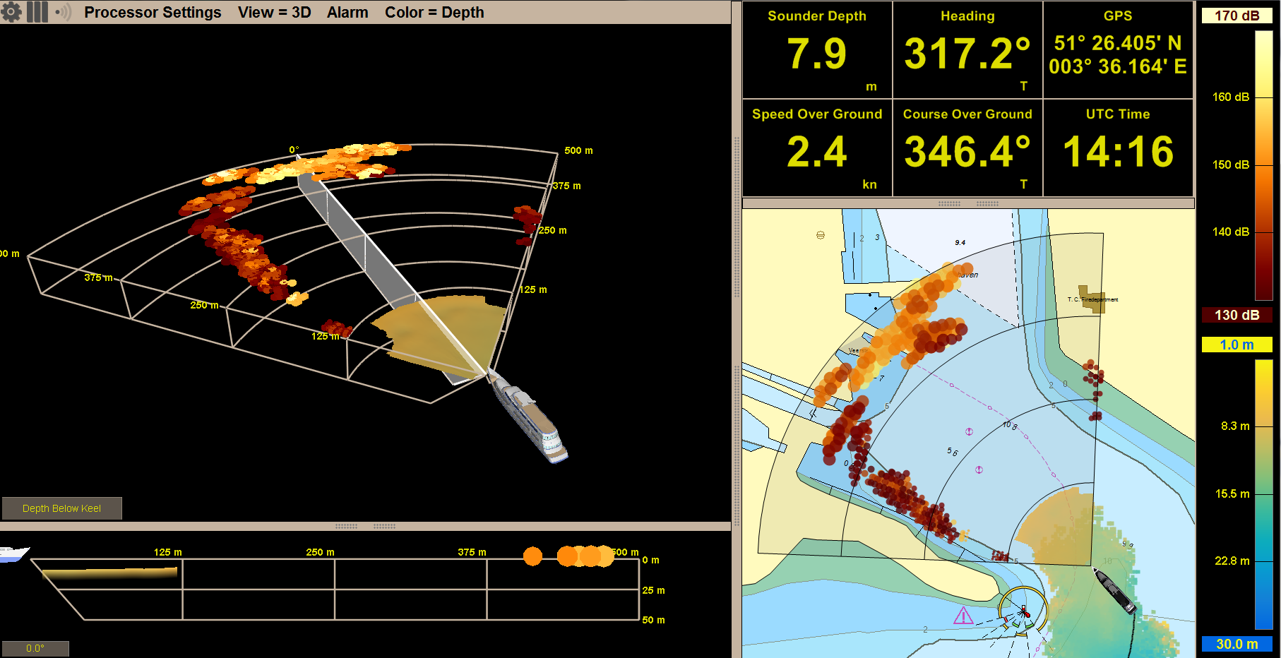
2017 marked the initial release of Local History Mapping (LHM)™. This innovative capability offers users the ability to build a 3D map of the seafloor over which they’ve recently sailed. This map is updated with every ping and is displayed as an overlay on top of the chart. This new overlay is displayed in conjunction with the real-time sonar overlay. When used together, one can quickly see what lies ahead and what they’ve recently passed over.
Local History Mapping™ is based on a bathymetric survey engine our team developed from scratch. FarSounder invested heavily in the database infrastructure associated with the storage and integration of large survey datasets that are collected. These investments allow us to quickly add new features and capabilities to our mapping capabilities. Based on customer feedback and our product roadmap, we have big plans, and additions to LHM™ is expected in the future.


Since the sonar systems have a wide horizontal field-of-view ahead of the vessel, it provides useful data quickly. A single pass of the 3D forward-looking sonar with LHM™ can survey a much wider swath of the seafloor than with a standard echosounder. In addition, the large coverage zone from a single ping results in a huge overlapping area from one ping to the next. This means that users won’t have to worry about missing any obstacles between pings.
“Argos” Arrival
The technology is regularly enhanced with updated SonaSoft™ software and the latest hardware. In late 2019 as we were rolling out some system enhancements, we decided it was time to give the series its own identity and give it a name - Argos. The name is based on the ship Argo from Greek Mythology: Legend says a magical piece of timber was placed in her prow guiding it safely on its journey.
The newest design of the system’s hardware has extensive bandwidth capability and a more modular and compact circuit design that may allow for future reductions in physical size and integration opportunities. These advances are some of the many things FarSounder is doing to continually improve on our products and provide our customers with the best forward looking sonar solutions.
The latest SonaSoft™ software offers an option for an even wider field of view - up to 120 degrees in short range mode. It also offers a faster refresh rate of less than 1 second. Along with other exciting features that offer users the quickest most accurate data they can get of what is under the water in front of their vessel.

Looking Forward to the Future
USVs
It is clear that USVs (unmanned surface vessels) will play a larger and more important role in the future of the marine industry. The Argos advanced underwater sonar systems can provide critical navigation capabilities for USVs, providing highly reliable detection of hazards, obstacles and shallows.
For example, FarSounder has been selected as a subcontractor on a research and development project led by GMATEK Inc. This project is contracted by the U.S. Navy’s US Naval Sea Systems Command (NAVSEA), Program Executive Office - Unmanned and Small Combatants (PEO-USC).
This research project’s objectives include applying machine learning and deep-learning artificial intelligence technology to identify solutions and develop a system to mitigate and compensate for sensor degradation onboard unmanned surface and undersea vehicles (USV/UUV).
Partnerships
FarSounder joined the International Hydrographic Organization’s Crowd-Sourced Bathymetry Working Group (CSBWG) initiative and is now a “trusted node” with NOAA. This project enables mariners to voluntarily contribute seafloor depths measured from their vessels to NOAA’s data repository.
Contributing data to the IHO Data Centre for Digital Bathymetry (DCDB) hosted by NOAA’s National Centers for Environmental Information will open it up for worldwide use. This can be used for a variety of purposes including in the assessment and production of nautical charts in all waters. This collaboration between FarSounder, the IHO, and NOAA will aid in making the world’s waterways a safer place to navigate.
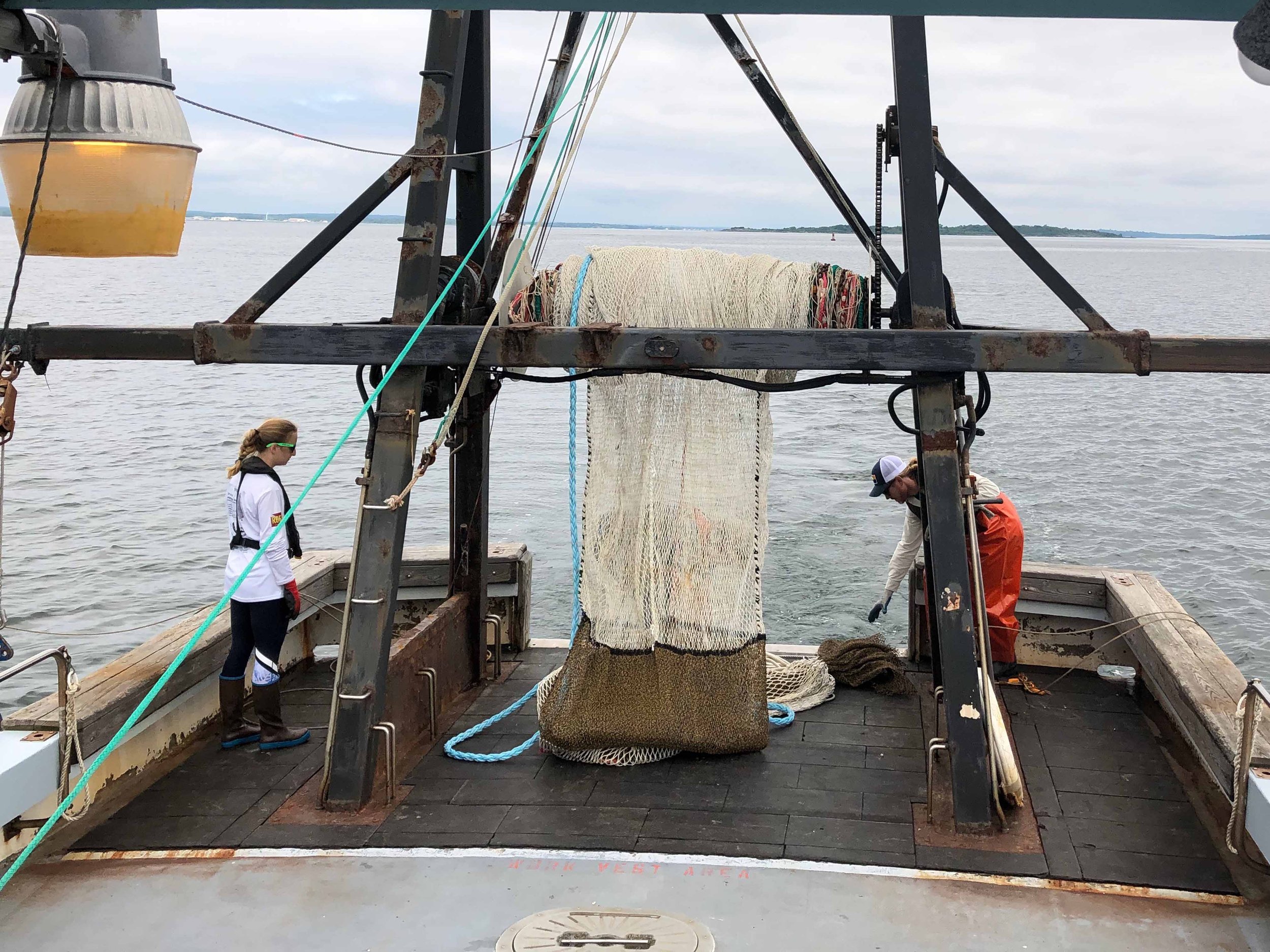
Fisheries Sustainability of the Ocean
It is a goal of FarSounder to develop new tools for the assessment and classification of fish; for abundance and biomass estimation. Research has begun in the use of underwater sonar tools for assessment and classification of pelagic fish species. The idea is to apply the use of Forward Looking Sonar in lowering/minimizing bycatch and thereby increasing the sustainability of the ocean.
FarSounder collaborated with TNO (The Netherlands Organization) and Jaczon (Commercial Fisheries Company) to develop a proof of concept to differentiate various species of pelagic fish (herring, mackerel, horse mackerel and sprat). Using a broadband forward-looking sonar, fish can be categorized in real-time, which enables the minimisation of a significant amount of undesired by-catch in the pelagic fishing sector. As part of the “Sonar for Fish Classification” (SOFIC) project, TNO developed and successfully tested a prototype. New sonar data can help to constantly improve this TNO algorithm for fish recognition.
Another project to note, FarSounder collaborated with the University of Rhode Island (URI) and the Rhode Island Department of Environmental Management (DEM) on pelagic fish data collection. The goal of this project is to develop a methodology to detect fish in the sonar imagery, calculating the biomass pelagic fish present, classify the species and to automate this process.