Overcoming Real World Navigation Challenges
The reality is there are limitations to traditional navigation tools, and the goal of the marine navigation technology industry is finding new ways to improve situational awareness. One innovative technology developed with this goal in mind is real-time 3D Forward Looking Sonar. For many mariners, including this type of state-of-the-art, proven technology into their workflow is a top priority.
Technology vs. Challenges
For those vessels that venture into poorly charted or uncharted waters, of course, 3D Forward Looking Sonar (FLS) technology is a valuable tool for them to have. However, the Argos 3D FLS technology can also provide great value for mariners with less exotic itineraries.
Technology can help minimize many navigation challenges all vessels face, but there are limitations. Some standard navigation technology is at times unreliable including GPS. The shipping industry is transporting goods across oceans in this global economy, and accidents are inadvertently littering our waterways with containers that are hiding under the surface. Chart data is oftentimes inaccurate or spotty thanks to mother nature and the sheer vastness of our oceans and waterways.
Here we highlight some of these types of challenging situations, based on recent maritime events or advisories. It is clear the use of 3D FLS could assist operators in navigating allowing for maximum safety. Particularly the Argos systems would be invaluable with its real-time data capabilities.
GPS Interference / Inaccurate Positioning
GPS may sound like an unlikely threat to safety given how crucial it has become to day-to-day navigation operations. However, a current advisory from the US DOT Maritime Administration warns:
Multiple instances of significant GPS interference have been reported worldwide in the maritime domain. This interference is resulting in lost or inaccurate GPS signals affecting bridge navigation, GPS-based timing, and communications equipment. Satellite communications equipment may also be impacted. Over the last year, areas from which multiple instances have been reported include the eastern and central Mediterranean Sea, the Persian Gulf, and multiple Chinese ports.
As you can imagine, the Maritime Administration advises the use of excess caution when operating under conditions of GPS disruption, and you can read more about their specific recommendations in the linked advisory. One vessel master managed to set an example of how to navigate safely under a GPS disruption using paper charts and radar systems in the Black Sea in June of 2017.
Situational awareness is crucial for navigation in a situation of GPS disruption - the vessel master highlighted above clearly used all of the functioning sensors at their disposal to increase their situational awareness and navigate safely, namely the Radar systems, paper charts, and it was also mentioned that the echosounder would have been useful had the vessel been in shallower water.
In this situation, if the vessel were to be equipped with an Argos 3D FLS, in addition to the approach taken - using both Radars and paper charts, manually adjusting the position in the ECDIS based on detected offset from relevant features on the shoreline - this would give the ability to use the 3D FLS to further reinforce the estimate of the vessel’s position. For example, if a reference was detected, navigation buoys or shoreline, at say 750m with both radars and sonar - that would reinforce confidence in the location. Of course, a radar system does not give any information about what is below the water line. Therefore, in addition to adding more redundancy to the procedure used to position the vessel and navigate, the Argos system would alert crew to any underwater navigation hazards that may not have been charted.
Unforeseeable Underwater Dangers
Shipping containers are lost at sea every year, most of the time due to poor weather conditions. Around 100 million containers are shipped across the globe each year. Although a small fraction of this number are lost at sea, there is still a significant amount out there never recovered and pose a serious risk to vessels. For example, just this year, the boxship ONE Apus lost about 1900 containers in a storm. This is just one of the examples of lost containers. There are many more accidents as well that leave behind these dangerous hazards.
Striking a container can be devastating to practically any vessel. These accidents can cause damage to the vessel’s hull and prove to be costly to repair. Detecting and avoiding collision with a submerged or partially submerged shipping container is difficult as there is no chart, radar, or GPS that will see it under the surface, ahead of the vessel, and in real-time. The added situational awareness of what is under the water ahead gained with the Argos systems are crucial to avoiding hazards such as these.
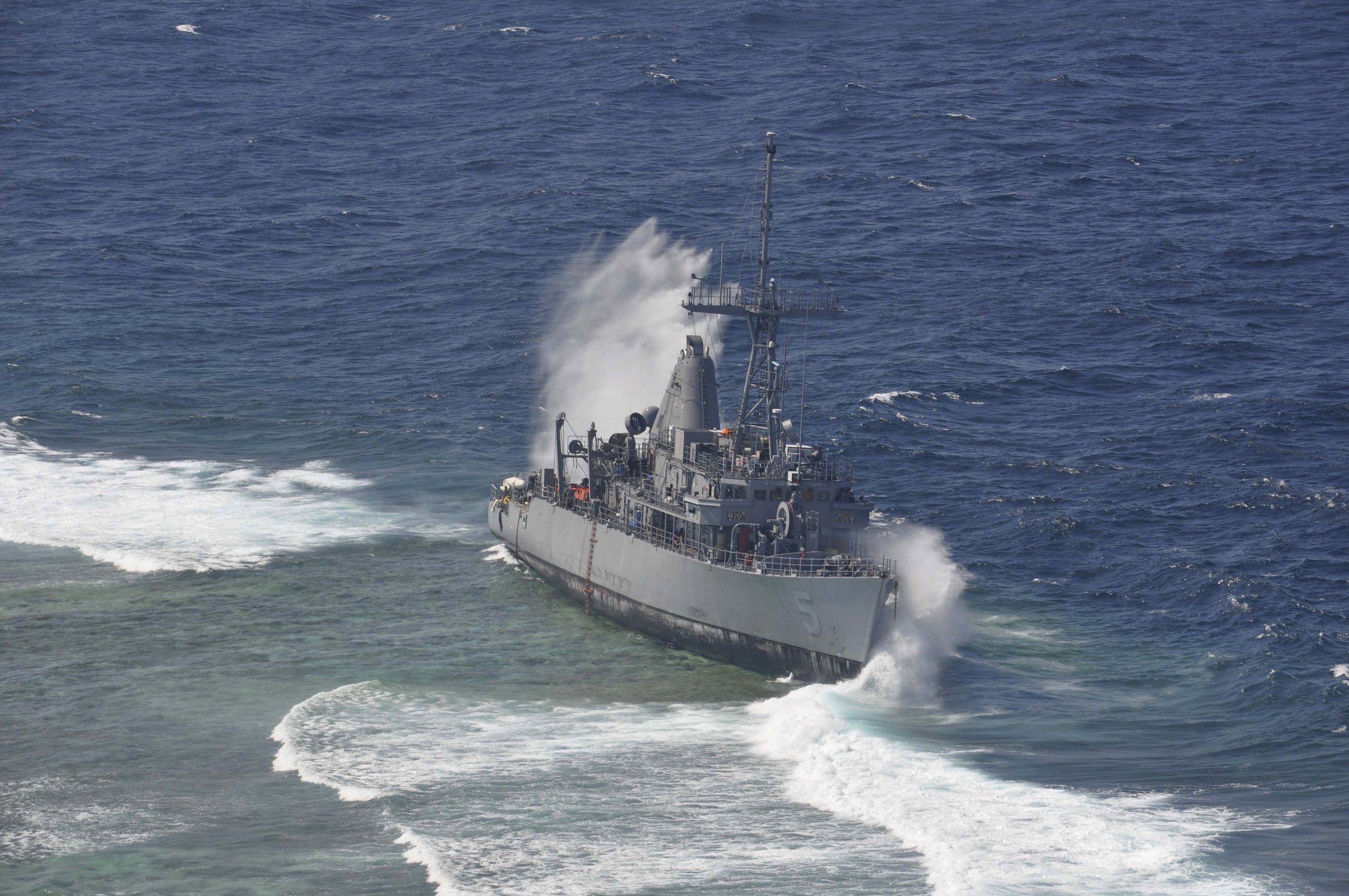
Figure 1 - USS Guardian grounded on incorrectly charted Tubbataha Reef in the Philippines
Another danger lurking under the surface is reefs. The ocean is shifting, growing and changing all the time. This fact has been brought to the forefront of the news recently when a coral reef that has been compared to the size of the Empire State Building was found off the northern coast of Australia at the northern tip of the Great Barrier Reef. Without recent survey data, there are no tools in the traditional navigator’s ‘toolbox’ that could have detected this hazard while cruising by. Though this specific example is 40m deep at its shallowest point, there could be others that are shallower and pose a risk to navigation. Navigating only using existing charts, GPS, radar and depth sounder in an area with uncharted, shallow reefs could have resulted in a collision.
In fact, in the past there have been notable reef accidents that bring this issue to life, namely the grounding of the USS Guardian (shown in Figure 1). The ship struck Tubbataha Reef off the coast of the Philippines causing millions of dollars in damage to the ship and the environment. It was determined that inaccurate chart data was one of the main causes of the accident.
This accident is just one of many strikes with reefs and shallows that happen every year. Some are larger and more costly than others. If vessel operators are able to see navigation hazards under the water in real-time, they can change course appropriately and avoid the danger posed by the hazard. There are many tools navigators use, but 3D real-time forward looking sonar is an important piece of the puzzle that can protect the environment and vessels from damage, and save lives.
Uncertainty in Chart Data
What kind of confidence do navigators have in charted depths and positions of hazards? One interesting fact is that overall about 95% of global coastal waters have depth information classified as either “medium accuracy (Zone of Confidence B)” or “poor accuracy (Zone of Confidence C, D, or U)” according to the IHO (S-67). That’s a huge area and can be concerning to vessel operators.
The International Hydrographic Organization (IHO) has recently established a guide intended to inform mariners (IHO (S-67)) on how to use Zone of Confidence (ZOC) categories to evaluate the quality of the data reflected in their paper or electronic charts, that is, understand what type of uncertainty they can expect to see between any charted depths or other navigation hazards and reality. The overall goal of this new guide, is “...to help mariners make informed decisions based on the data in their on-board navigation systems...” They suggest that though the Zone of Confidence data is available in ECDIS systems, it’s common to turn it off during route planning and during the journey because it “clutters the screen”. Of course a better understanding of the position and depth uncertainty in the nautical chart is useful for any navigator.
Figure 2 - Acceptable depth uncertainty in Zone of Confidence Categories B and C
The IHO has established six Zone of Confidence (ZOC) categories for evaluating the accuracy of the information represented on navigational charts. ZOC A represents an area of “high accuracy depth information” and is common inside ports, harbors, etc., that have been well and frequently surveyed. Only about 5% of coastal water is represented with high accuracy depth information according to IHO S-67. Of the rest of the coastal water, they are most likely to be represented by one of two categories.
Specifically, 40% of the world's coastal waters are classified as Zone of Confidence B and around 30% Zone of Confidence C. Of course, some areas are of much higher confidence, ZOC A1 or A2, however this suggests that around 70% of coastal waters are either ZOC B or C, so data of this quality is what a mariner is perhaps most likely to encounter in coastal waters outside of a port or harbor.
Table 4-1 in IHO S-67 gives all of the details, however in summary, ZOC B data has a position uncertainty up to 50m and a depth uncertainty of up to 1 m + 2% of the depth, while ZOC C data may have an uncertainty in position of up to 500m and an uncertainty of 2m + 5% in depth. Figure 2 plots the acceptable uncertainty in depth for zones B and C up to a depth of 15m.
Further, in terms of seafloor coverage, a full search of the area for navigation hazards was not achieved in either of these categories. So that it’s possible that uncharted navigation hazards or depth anomalies exist (though for ZOC B it is “unexpected”).
For example, in ZOC B/C areas, of course navigators will want to exercise caution, and follow all recommendations of the IHO S-67 guide. The image generated by the Argos 3D FLS can be used to corroborate the charted data when both the sonar and the chart are in agreement. If the data indicates they are not in agreement, more precautions should be observed by the navigator. Further, given in both these ZOC categories, “uncharted features hazardous to surface navigation may be present”, the Argos system is invaluable for informing the mariner about the current situation in front of their vessel, under the water.
Conclusion
The added situational awareness provided by an Argos system is critical to challenging navigation areas including in uncharted and poorly charted areas, or tropical regions with the ever changing environment. As you can see, even if your itinerary does not include venturing off the beaten path, an Argos system is a valuable addition to your navigation toolbox and an added layer of safety to be seriously considered.
Don’t get caught in any of the sticky situations highlighted above without one!