
News
Search our News:
Working Together to Map the Seafloor
Imagine if protecting the fragile underwater ecosystems and reaching business goals were simultaneously achievable. Imagine if a vessel operator could make valuable contributions to global initiatives without changing their daily operations. Imagine if our map of the seafloor here on Earth was as detailed as our map of the surface of Mars. At FarSounder, we have discovered that these first two ideals are actually a reality, and support the third dream. Safety at sea is a top priority for the marine industry for many reasons. Not only is safety important to a successful voyage and achieving business objectives, but also, for protecting the ecosystem. It is something many of us think about everyday while working to find ways to improve safety to keep our business strong, and in turn, the ecosystem thriving.
Yachts, science, and sustainability
Megan Hickling dissects a roundtable discussion on linking yachting enthusiasts with scientists and fostering ocean science for climate action…
An online roundtable held on 6th December, brought together representatives from Triton Submarines, International Seakeepers Society, Shadowcat, and FarSounder to discuss how and why yachts and science should connect for the better, as well as potential barriers to this collaboration.
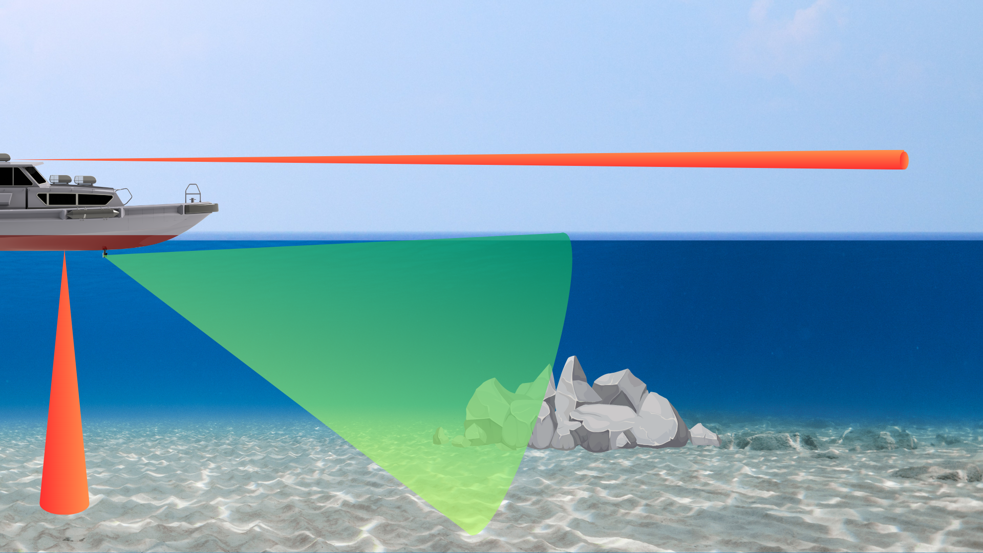
Sustainability and ROI Come Together With Forward Looking Navigation Sonar
Protecting the fragile underwater ecosystems and achieving business goals don’t always go hand in hand, but it can. Preventing groundings and collisions means minimizing ship downtime, avoiding injury to passengers, crew and wildlife, and reduction in accident-associated environmental penalties.
Three Dimensional
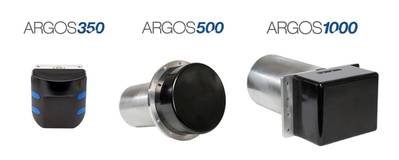
FarSounder’s Argos 3D Forward Looking Navigation Sonars are the most effective way to truly know what lies ahead of your yacht along the bottom and in the water column. With detection ranges out to 1000m, Argos sonars give yachts ample time to see hazards ahead, from the water’s surface down to the seafloor with a fast update rate, wide field of view, and an intuitive user-interface.

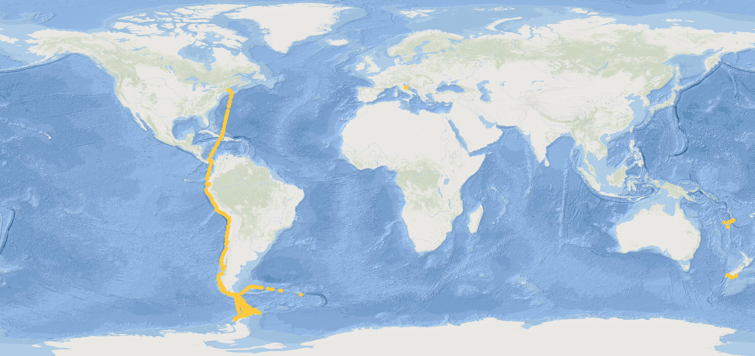
Crowdsourcing Bathymetry
Fortunately, expedition vessels have a wide range of navigation sensors they can use in conjunction with their charts to help them navigate such waters more safely. While navigating in these locations, these explorers are able to be a part of the solution through a worldwide crowdsourcing initiative. They have the opportunity to contribute to the global community by recording their depth and position observations along the way.
Unmanned Surface Vessels Growing Need For Underwater Obstacle Avoidance
As missions expand to long duration coastal monitoring, security patrols in austere ports, force projection into higher latitudes, ship-to-shore wayfinding, and high speed interdiction, consideration of underwater navigation hazards is becoming a priority for USV many operators.
How the Yachting Community can help charting the Planet’s Seabed
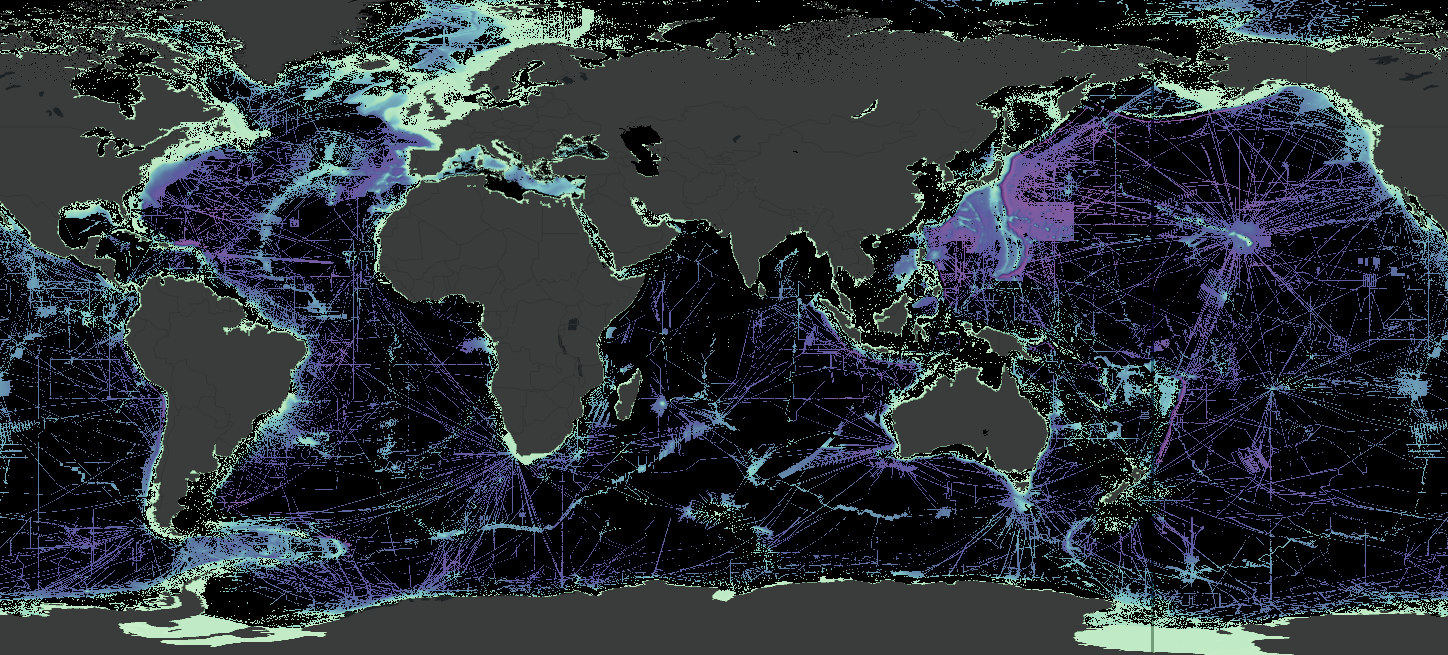
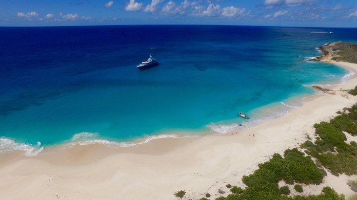
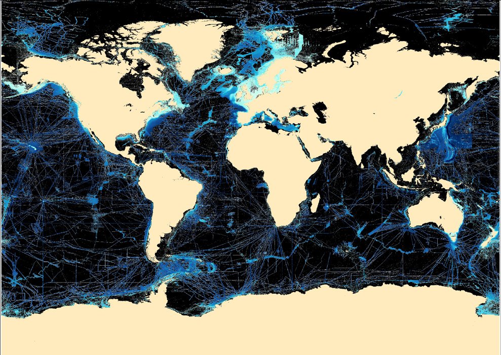
One allure of yachting for many owners and guests (and even crew) is the adventure of cruising through pristine waters and voyaging to some of the most exclusive locations in the world. Exploration into the unknown allows us to be immersed in the unspoiled beauty of our marine world. According to Seabed 2030 (a global initiative to map the world’s oceans by 2030), we’ve mapped less than 24% of the world’s sea floor. “We know the topography of the Moon and Mars in greater detail than that of our own planet.”
When safe navigation becomes passive research
A common misconception when looking at a large-scale chart is that there is a reliable level of resolution on the seafloor. According to Seabed 2030, less than 25 percent of the world's oceans have been surveyed at all, and much of this only at 100m resolution.
What Lies Ahead
Imagine operating your boat by only looking in a rear-view mirror, while someone tells you what’s in front of you. Sound a bit challenging? Well, as far as anything under the water is concerned, this is exactly how most boaters do it.
Mapping our Ocean with the help of superyachts
For many owners and guests, the allure of yachting is the adventure of cruising through pristine waters and voyaging to some of the most exclusive locations in the world. These unique experiences stem from a fundamental urge to explore our world and see its beauty.
Yachting Contributions to Global Community
For many, yachting’s allure is the adventure of voyaging to some of the most exclusive locations in the world. This means venturing into the unknown.
Confident Cruising
Groundings and collisions cost lives and money and have significant environmental impacts. What is ahead of the vessel and underwater is the most essential navigation information that can mitigate a dangerous situation. The best prevention is to have a suite of tools working together to provide you the most information possible allowing for heightened situational awareness.
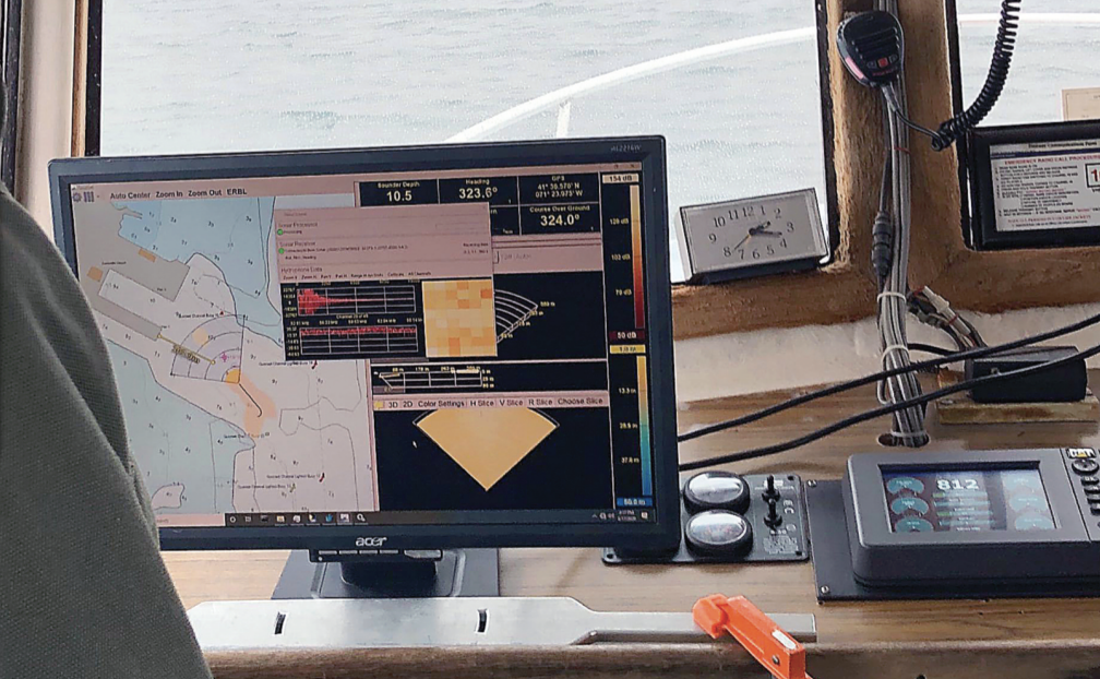
Mapping the Sea Floor - Innovations in Forward Looking Sonar
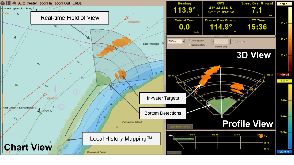
All Argos FLS systems use FarSounder’s SonaSoft™ software for processing and displaying data. Its main function is to view real-time data in the path of the vessel. In addition to detecting the seafloor and hazards ahead in real-time, it also has a unique application called Local History Mapping™. The application stores this data for use as additional information to supplement older chart data.
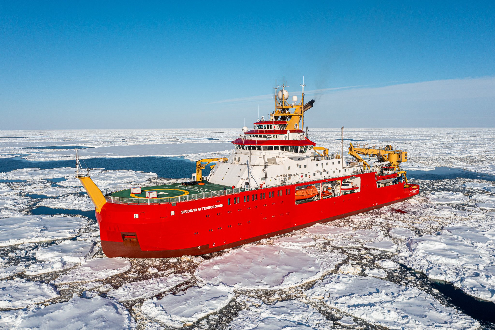
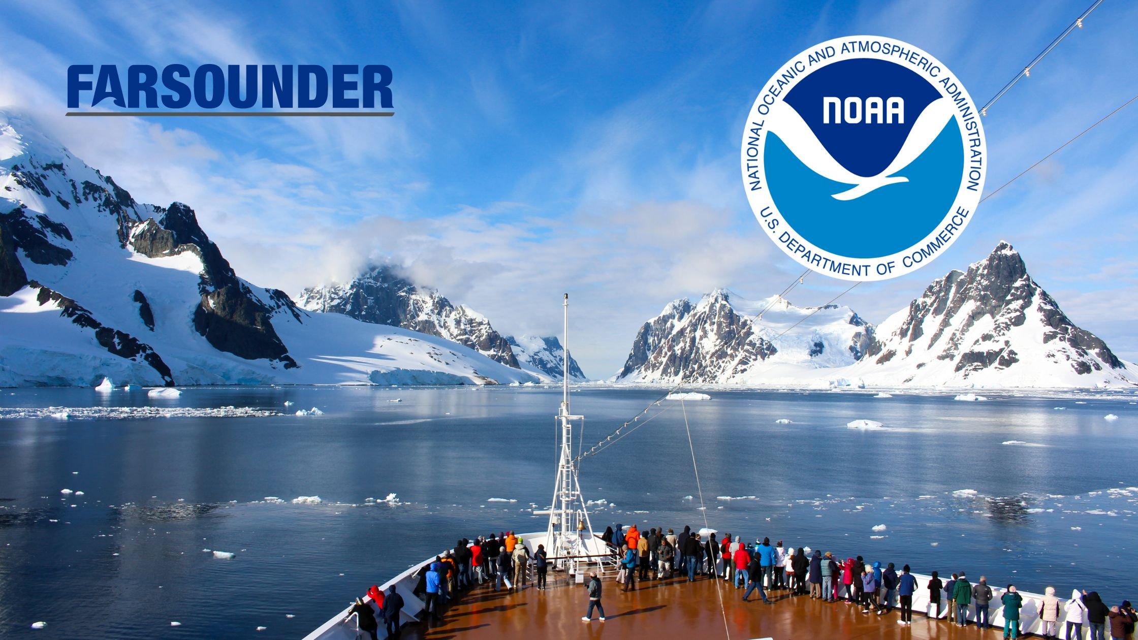
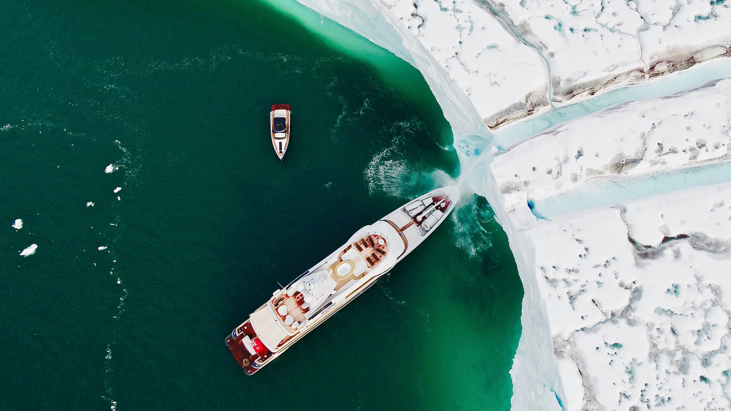
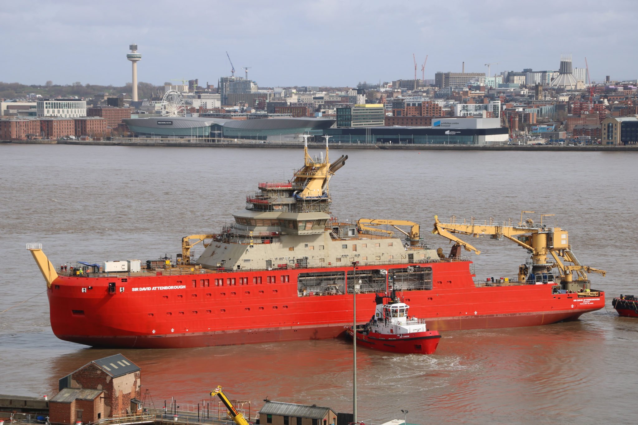
RRS Sir David Attenborough Completes Ice Trials
The RRS Sir David Attenborough, equipped with FarSounders Forward-Looking Sonar, completes ice trials during its maiden voyage to Antarctica – a critical milestone in the commissioning of Britain’s new polar ship.

Update for Argos: Software Collaboration Enhances Forward-Looking Sonar
On the evergoing journey to protect the ecosystem and keep vessels and passengers safe, FarSounder and Navtor are making and impact. They share the same core goals of improving ocean safety through innovation and technology while simultaneously keeping the focus on the customer.
Farsounder Recommends Propspeed FoulFree for Sonar Transducers
Propspeed, an innovator of underwater foul-release coatings, received an endorsement from FarSounder, a pioneer in navigation and obstacle avoidance systems, which has tested the Propspeed Foulfree foul-release coating and recommends it for application by their customers, dealers and partner shipyards.
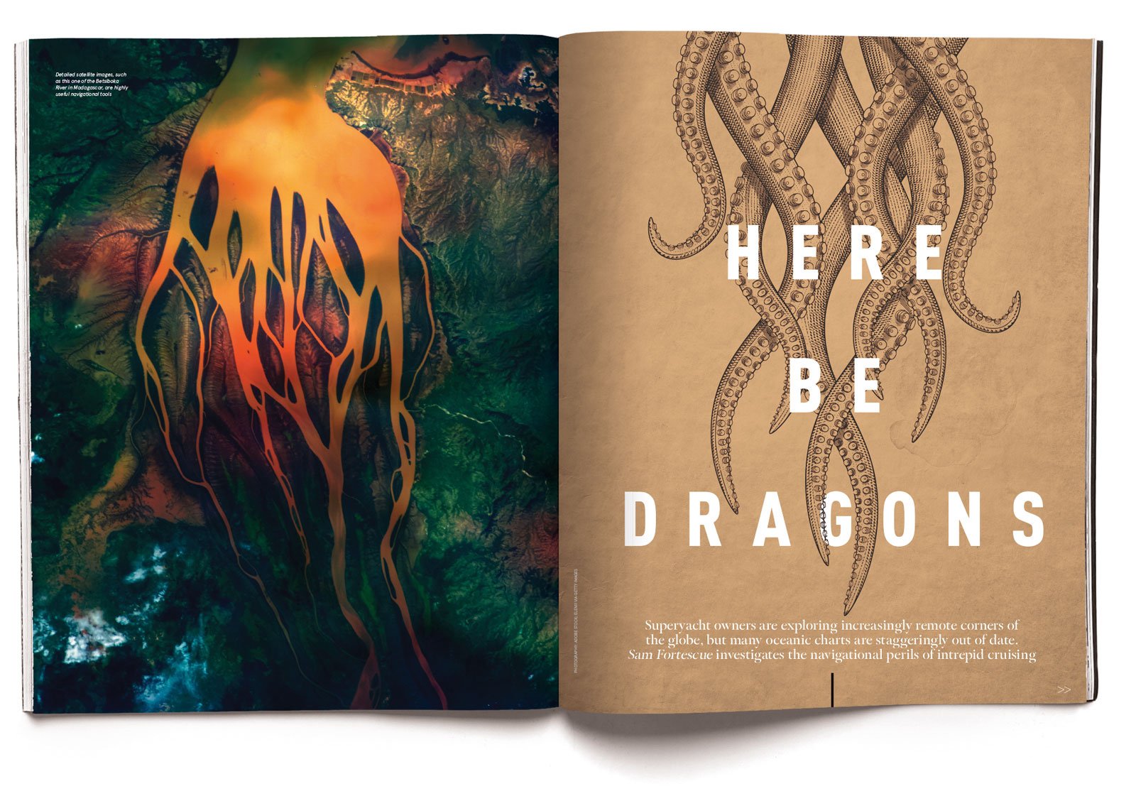
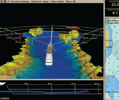
Here Be Dragons
“An alternative is the American-built FarSounder, which gives you a sonar picture of the seabed up to 1,000 metres ahead. Fitted to the mothership, it is a six-figure investment and the boat needs to be hauled out for installation, but it works at speeds of 20 to 25 knots. “Our systems are designed to map the sea floor in 3D out to a range of at least eight times the depth of water below the transducer module,” says Matt Zimmerman, Farsounder’s executive vice-president of engineering. “However, even in shallow water, they can detect in-water obstacles out to the full range of the sonar. We have had a number of customers report that they can see large whales with the sonar.”
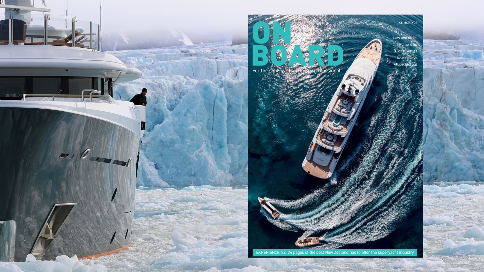
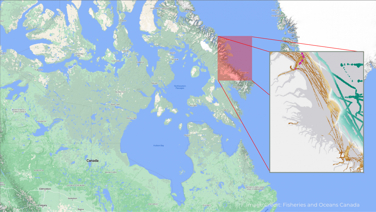
Safely Navigating Polar Regions
Relying heavily on chart data and standard navigation tools for safe navigation is risky. Vessels will find themselves in dangerous situations due to lack of data. This is particularly relevant in polar regions. These areas are poorly charted at best and at worst are mostly uncharted territories.
FarSounder - Giving Vessels an Underwater Eye Ahead
In the late 1990s, electrical engineering student Mathew Zimmerman and James H. Miller, his professor of Ocean Engineering at the University of Rhode Island, had an idea for an improved sonar system that could look ahead of a vessel and warn of subsea obstructions, like the rocks that punctured the hulls of the Exxon Valdez and QE II. They Officially began work on their forward-looking sonar in 2001 and launched the first product, the FS-3 Navigation & Obstacle Avoidance System, three years later. Since then, FarSounder has received several patents for their 3D forward-looking technology.

Women at the Helm: Cheryl Zimmerman - FarSounder
From DSNM: This is the third in our inspiring series about great female leaders within the superyacht industry. Find out more in this blog about Cheryl Zimmerman and her journey to the very top of FarSounder, producers of 3D forward looking marine navigation products for obstacle avoidance and shallow water navigation.