Doing it for Science: 3D Forward Looking Sonar for Research Vessels
As FarSounder's customer base grows, we are continually learning about new applications for our navigation sonar products. As a marine company focused on engineering unique technologies, we obviously have an interest in the greater world of marine science. Though we do not study the occean per se, our products can be used as tools to help others study the ocean. This blog entry is intended to highlight some of the applications of our 3D navigation sonars for Research Vessels. With these products, we hope not only to provide safer navigation to users but also add some compelling reasons to add our tool to the researcher's arsenal of tools.
Multibeam and Towfish Safety

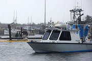
Researchers deploy equipment from an RV
By definition, when performing an oceanographic survey, the area being surveyed is unknown. This area may be dangerously shallow and the survey's mission is to determine just how shallow the water really is. In this case, an expensive multibeam sonar may be installed on a ship or boat and that vessel travels through the unknown waters. These vessel operators rely on local knowledge, visual sightings (when in clear water) and their ship's echo sounder to give them an idea when the waters are too shallow for their vessel. Sometimes these techniques work. However, there is always the significant risk that the vessel will run aground or collide with an unknown obstacle (like an old submerged piling, a coral head, or rocks). In these cases, significant damage could occur to the ship and/or survey tools.

Multibeam survey of a seamount
In other cases, a towfish may be used to perform a sidescan, multibeam, or sub-bottom profile survey. During these operations, the towfish must "fly" a short distance above the sea floor. The towfish operators must rely on the towing vessel's echo sounder to see the obstacles that they've just passed over. These obstacles may be at safe depths for the transitting vessel, yet they may be significant hazards to the tow fish. Generally, the operators hope that they can detect the hazard with the ship's echosounder and raise the towfish in time to avoid a collision. Sometimes that works, sometimes it doesn't. Those who work in the marine markets have heard many stories of towfish running aground causing extensive damage to expensive equipment. Forward looking sonar on the surface ship can help protect all sorts of towed equipment.
Arctic Exploration

Navigating through the ice
As the arctic ice cap melts, northern sea routes and EEZ borders are areas of research that are gaining interest. Canada, Germany, Russia, and the United States are all actively exploring the arctic regions in search of scientific and commercial gains. The modern explorers who are seeking to expand our knowledge of these areas are generally navigating without significant knowledge of the sea-floor. FarSounder's 3D sonars can be used here to help avoid groundings in these poorly charted waters as well as help scientists identify bathymetric features of interest. Our sonars can help a vessel follow a sub-sea ledge and identify bottom targets of interest which may be catalogued for future study. For example, while navigating through a newly discovered route, the sonar may be used to detect pinnacles and other bottom structures that may be worth a closer look. Of course, large icebergs also make excellent sonar targets.
Post Disaster Response
Navigating post disaster
After a life changing natural disaster like a large hurricane or tsunami, known waterways often become unknown with scattered debris blocking channels. Silt, sand or rocks may have been moved by the force of mother nature. In these cases, research vessels may be called into action to help survey former routes and reopen channels for incoming post-disaster aid as quickly as possible. In these cases, the survey vessels must enter areas with potential navigation dangers. Once again, a 3D forward looking sonar can be used to help these vessels complete their mission safely, avoiding groundings and collisions. In these cases, the navigation hazards could be rocks, lost buses, trucks or cars, and even newly sunken boats, barges, and oil rigs.
Upcoming Oceanographic Toolsets
The above examples highlight some of the uses of our standard forward looking navigation and obstacle avoidance capabilities. However, the engineering and R&D team at FarSounder is always looking to expand the technical capabilities of our products. As mentioned in a previous blog entry, we've completed proof-of-concept testing where our standard navigation sonars were used to generate bathymetric charts using industry standard 3rd party charting tools. Once commerciallized, this capability will add a new toolset to the existing hardware.
We've also noticed another non-traditional ocean observation application that may be of interest to some RV customers. As part of some of our R&D testing, we noticed that we can monitor some types of fish schools. We've even witnessed preditory actions below the water, watching blue fish and striped bass feeding on schools of bait fish. We briefly discussed some of these results in another blog posting. These observations used a special engineering version of our software and are not possible with our default navigation software. However, if you think this type of tool would be useful as part of your testing, please don't heasitate to contact us. We love to work on special projects.
Lastly, we have some new innovations related to oceanographic measurements which we think could revolutionize some of the routine yet costly measurements that oceanographers often perform while at sea. We're not ready to talk about them just yet. But I'm certain that once we announce this new technology, oceanographers will be very excited to try it out. We'll be sure to have a blog posting about it and probably produce a white paper or two.