Tech Blog
Search our Tech Blog:

FarSounder’s Sharing Across the Fleet Program
Our Argos sonars produce two types of data: 3D Forward Looking Sonar data (that’s the realtime image ahead of the vessel, inside the sonar’s field-of-view) and Local History Map data (the depth map of everywhere the vessel goes).
By default, all data lives aboard the vessel on the FarSounder bridge computer. However, users can opt-in to anonymously share their Local History Map data across the FarSounder fleet. In exchange, they receive the aggregate map built from everyone’s contributions. Plus, we contribute depth measurements anonymously on their behalf to Seabed 2030, a global effort to help map the world’s oceans.
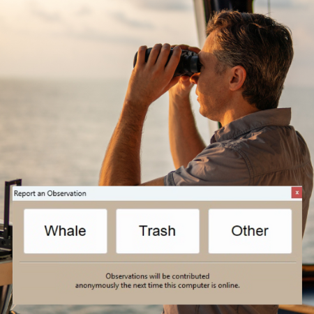
Citizen Science: Contributing Whale and Trash Sightings
Since 2023, FarSounder customers have been engaging in citizen-led science simply by using their Argos Forward Looking Sonar systems and sharing data with very little effort. There are multiple features in which users can participate in global marine initiatives through contributing bathymetric data they collect and reporting whale and trash sightings.
Datasharing, Crowdsourcing and Community Contributions
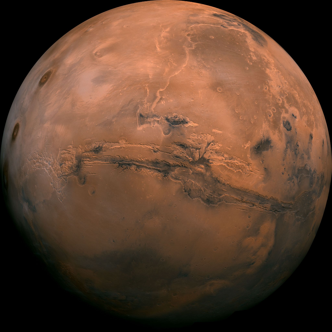
“We know more about the surface of Mars than we do about the seafloor here on earth” is a rallying cry that has been heard across the marine world. Perhaps you are interested in a better understanding of our world and want to know if you might be able to help improve our knowledge. Crowdsourcing, data sharing, and citizen science initiatives are common terms, but understanding how you and your vessel can contribute to these efforts can be confusing. This tech blog is intended to clarify your options and explain how to get involved using an Argos forward looking sonar.
Sharing Across the Fleet
We are moving our Local History Map™ off the vessel to share across the FarSounder fleet and enabling our customers to contribute to global efforts to build a complete map of the sea floor across all the world’s oceans. Participants receive the benefit of backing up the Local History Map™ they collect in the cloud and have the satisfaction of knowing that contributions will benefit the community and may be included in the Seabed 2030 initiative.
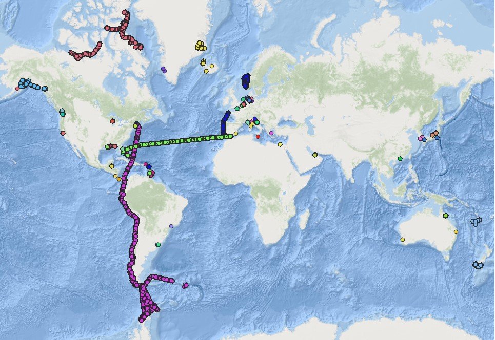
Expedition Sourced Data Collection Program: Progress Update
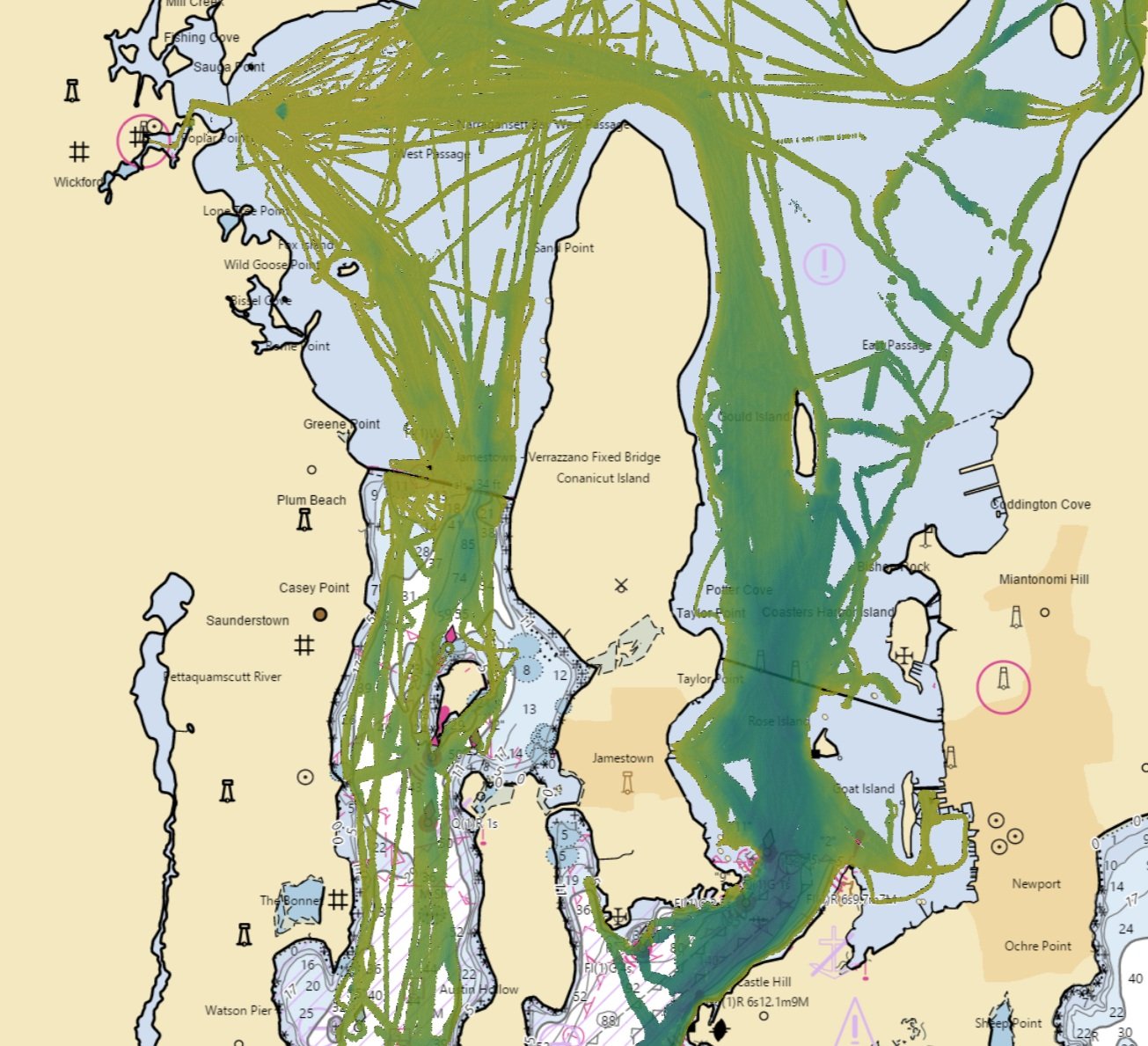
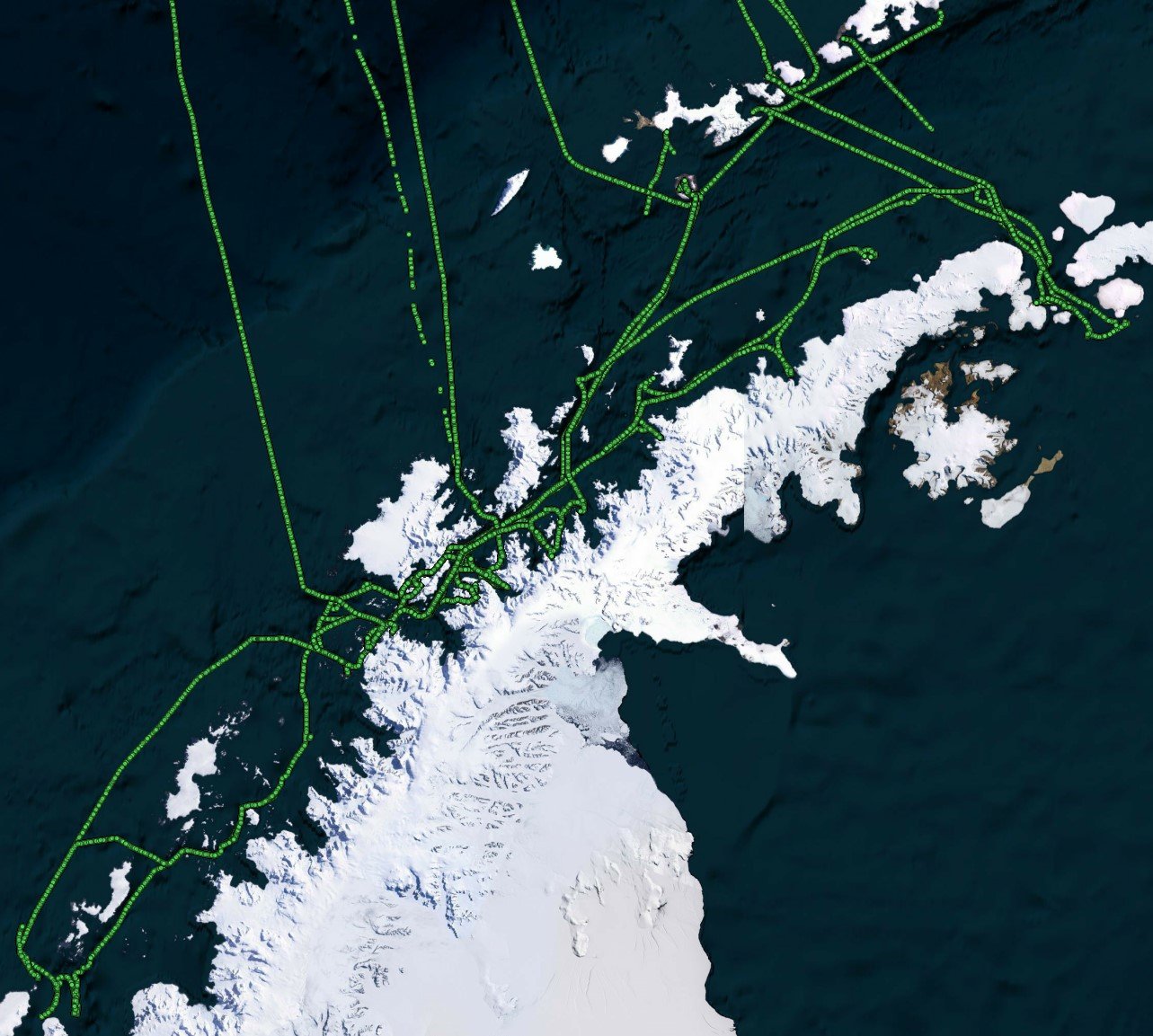
FarSounder has been collecting sonar data from customers in remote locations around the globe for a few years now. We have received more than 30 TB of sonar data from customers’ expeditions. The data collected is from many fascinating areas including a transit of the Northwest Passage, from Boston to Antarctica, following the west coast of South America, and the South Pacific. When in poorly charted or uncharted waters, the interesting bathymetric features and navigational hazards that can be observed in this data are invaluable. As an example of a case where these are present in the data, below is an overview of some of FarSounder’s bathymetric data from our local waterway, Narragansett Bay.
A First Look at Expedition Sourced Data
Recently, FarSounder launched an Expedition Sourced Data Collection program allowing customers to record data during their normal operations. We already have a fleet of customers collecting data as they use FarSounder's real-time 3D-FLS to increase safety in their day-to-day operations. Some of the exciting areas they are exploring include the arctic and antarctic waters, as well as the Caribbean.
Expedition Sourced Ocean Data Program: Surveying the Seafloor
The world’s oceans and the environments they encompass are vast and varied. The bathymetric contours and acoustic conditions found in the seas, oceans, and bays throughout the latitudes mirror this complexity. FarSounder sonars are designed to bring clarity in these varying conditions to the operators aboard our customers’ ships. Over the years, we’ve amassed many terabytes of sonar data from vessels and locations around the world with varying times of year, installation types, vessel speeds, and signal types. This data is used to continually test new software releases and algorithms.