
Argos Navigation Sonars
3D forward looking at navigationally significant ranges
FarSounder’s systems are the only products on the market capable of generating a true, 3-dimensional image ahead of a vessel in real-time. Operational and reliable at navigationally significant ranges up to 1000 meters (1/2 nautical mile) and speeds up to 25 knots, the Argos Series allows users to navigate safely and confidently. The system software is able to be integrated in many bridge systems.


Argos Navigation Series
The Argos Series improves navigation safety by detecting underwater hazards and shallow bottoms up to 1000m ahead of the vessel. These forward looking sonar systems produce real-time 3D imagery providing users with the knowledge to know where it’s safe to navigate. With this patented technology, users are able to travel in unknown and unchartered waters. We understand safety is the #1 priority and at the same time, see the importance of nurturing one's sense of adventure and enthusiasm for exploring new places
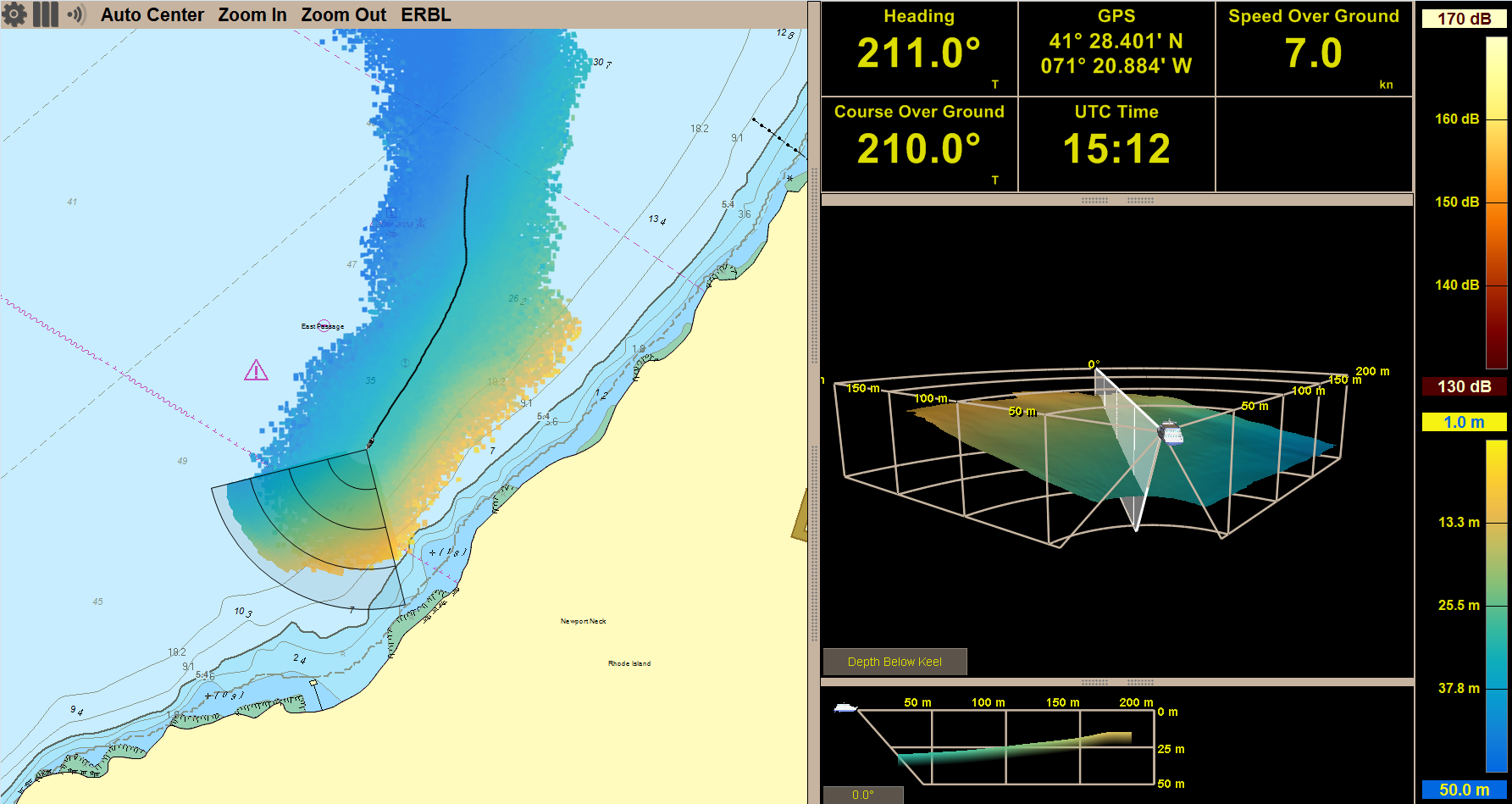
Painting a Clear Picture of What Lies Ahead
Our chart overlay and 3D sonar displays make it easy to quickly understand what lies ahead underwater. Our fast update rate paints the entire 3D image with a single ping eliminating wait time. Over the years, we have developed an easy-to-understand interface giving captains and crew an user friendly real-time picture of what lies ahead on the seafloor and in the water column.

High-tech Sonar Processing
FarSounder navigational sonar systems have a unique phased array technology, which transmits a wide transmission of sound. This allows for single-ping 3D-processing and fast refreshes. As a result, the systems aren’t limited by multipath interference, roll/pitch, surface effects, and ship motion. And with our easy to understand technology, navigators can distinguish between the seafloor and dangerous in-water obstacles through the systems’ processing of depth measurement and color mapping.
Local History Mapping™ (LHM)
Our Local History Mapping™ capability gives users the ability to build a 3D map of the seafloor where they’ve recently sailed in the chart overlay view. Navigators will see a color-coded, real-time picture of the sea floor ahead of the vessel, as well as where they have been. Since our sonar has a wide horizontal field-of-view ahead of the vessel, a single pass of an Argos 3D forward-looking sonar with LHM can map a much wider swath of the seafloor than a standard echosounder.